Approximate Location Map
Large Map »
Latitude: 50.6861 / 50°41'10"N
Longitude: -2.1088 / 2°6'31"W
OS Eastings: 392411
OS Northings: 87390
OS Grid: SY924873
Mapcode National: GBR 32T.TZC
Mapcode Global: FRA 67G8.B8G
Plus Code: 9C2VMVPR+CF
Entry Name: 16, East Street
Listing Date: 7 May 1952
Grade: II
Source: Historic England
Source ID: 1323577
English Heritage Legacy ID: 107963
ID on this website: 101323577
Location: Wareham, Dorset, BH20
County: Dorset
Civil Parish: Wareham Town
Built-Up Area: Wareham
Traditional County: Dorset
Lieutenancy Area (Ceremonial County): Dorset
Church of England Parish: Wareham Lady St Mary
Church of England Diocese: Salisbury
Tagged with: Building
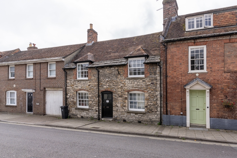
1.
5190 EAST STREET
(South Side)
No 16
SY 9287 1/60 7.5.52.
II GV
2.
C18. Coursed Purbeck rubble. Brick dressings and voussoirs. Pitched tile roof.
Stone slates above eaves. Red brick stack. 1½ storeys. 2 ranges of sashes with
glazing bars, hipped gables over those on 1st floor. Flush-panelled door.
Nos 2 to 20 (even) form a group.
Listing NGR: SY9241087391
External links are from the relevant listing authority and, where applicable, Wikidata. Wikidata IDs may be related buildings as well as this specific building. If you want to add or update a link, you will need to do so by editing the Wikidata entry.


Other nearby listed buildings
