Latitude: 50.7054 / 50°42'19"N
Longitude: -2.3903 / 2°23'24"W
OS Eastings: 372537
OS Northings: 89602
OS Grid: SY725896
Mapcode National: GBR 0ZL.NHZ
Mapcode Global: FRA 57W6.W1J
Plus Code: 9C2VPJ45+5V
Entry Name: Praps Cottage the Gardens
Listing Date: 26 January 1956
Last Amended: 10 March 1987
Grade: II
Source: Historic England
Source ID: 1323644
English Heritage Legacy ID: 106384
ID on this website: 101323644
Location: West Stafford, Dorset, DT2
County: Dorset
Civil Parish: West Stafford
Traditional County: Dorset
Lieutenancy Area (Ceremonial County): Dorset
Church of England Parish: Dorchester and West Stafford
Church of England Diocese: Salisbury
Tagged with: Cottage Thatched cottage
WEST STAFFORD SY 7289
16/195 Praps Cottage and The Gardens 26.1.56 (formerly listed as Pair of Cottages 20 yards south of Church
GV II
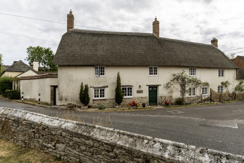
Pair of semi detached, but not identical cottages. Probably C18. Plastered cob walls on rubble stone base. Thatched roofs. Brick stacks, one at left end of Praps Cottage, one near centre, and one at right end of The Gardens. 2 storeys. Praps Cottage has panelled door. Ground floor has 4 casements with glazing bars, one in a blocked doorway. First floor has 3 similar casements. The Gardens has raised plaster quoins at right end. One casement with glazing bars on each floor. Right of the house a plastered cob wall with entrance gate into yard. Entrance to house in end wall. At the rear, a later range of brick, with thatched roof - parallel to the front range. This extended to right in C20 in brick and thatch, at first floor level; the ground floor open, as a covered way, on stone piers. (RCHM Monument 8. Dorset Vol II)
Listing NGR: SY7253189599
External links are from the relevant listing authority and, where applicable, Wikidata. Wikidata IDs may be related buildings as well as this specific building. If you want to add or update a link, you will need to do so by editing the Wikidata entry.


Other nearby listed buildings