Latitude: 50.7342 / 50°44'3"N
Longitude: -2.7539 / 2°45'14"W
OS Eastings: 346890
OS Northings: 93001
OS Grid: SY468930
Mapcode National: GBR PP.L65N
Mapcode Global: FRA 5734.JYH
Plus Code: 9C2VP6MW+MC
Entry Name: 26, Barrack Street
Listing Date: 19 September 1975
Grade: II
Source: Historic England
Source ID: 1324062
English Heritage Legacy ID: 104461
ID on this website: 101324062
Location: Bridport, Dorset, DT6
County: Dorset
Civil Parish: Bridport
Built-Up Area: Bridport
Traditional County: Dorset
Lieutenancy Area (Ceremonial County): Dorset
Church of England Parish: Bridport St Mary
Church of England Diocese: Salisbury
Tagged with: Building
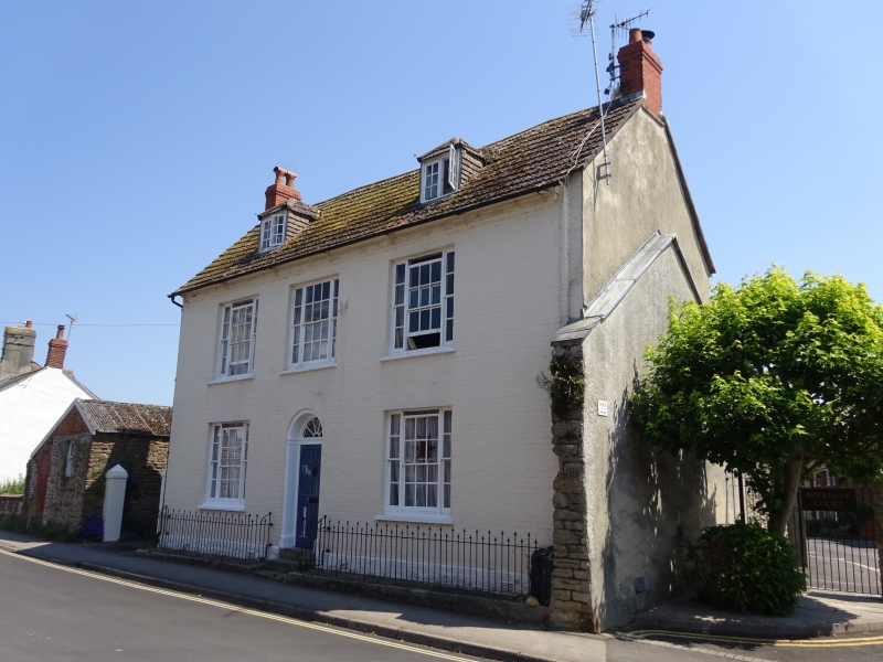
1.
5191 BARRACK STREET
(East Side)
No 26
SY 4692 1/36
SY 4693 5/36
II GV
2.
Late C18. Painted brick. Pitched slate roof. 2 storeys and attics. Eaves
cornice with alternate fluting and paterae to frieze. 3 ranges of 3-light
sashes. Door with fielded panelling, fanlight and flanking pilasters. 2
hipped attic dormers.
Listing NGR: SY4689492993
External links are from the relevant listing authority and, where applicable, Wikidata. Wikidata IDs may be related buildings as well as this specific building. If you want to add or update a link, you will need to do so by editing the Wikidata entry.


Other nearby listed buildings