Latitude: 51.0384 / 51°2'18"N
Longitude: -2.277 / 2°16'37"W
OS Eastings: 380676
OS Northings: 126596
OS Grid: ST806265
Mapcode National: GBR 0VP.TBL
Mapcode Global: FRA 663C.QRN
Plus Code: 9C3V2PQF+96
Entry Name: Vicarage School Room and The Parish Office
Listing Date: 16 August 1960
Last Amended: 3 January 1985
Grade: II
Source: Historic England
Source ID: 1324572
English Heritage Legacy ID: 102981
ID on this website: 101324572
Location: Gillingham, Dorset, SP8
County: Dorset
Civil Parish: Gillingham
Built-Up Area: Gillingham
Traditional County: Dorset
Lieutenancy Area (Ceremonial County): Dorset
Church of England Parish: Gillingham St Mary the Virgin
Church of England Diocese: Salisbury
Tagged with: Architectural structure
This list entry was subject to a Minor Amendment on 13 May 2024 to update the name and address and to reformat the text to current standards
ST 8026
12/142
GILLINGHAM
QUEEN STREET (east side)
Vicarage School Room and The Parish Office
(formerly listed as Vicarage Schoolroom, previously listed as Vicarage outbuildings)
16.8.60
GV
II
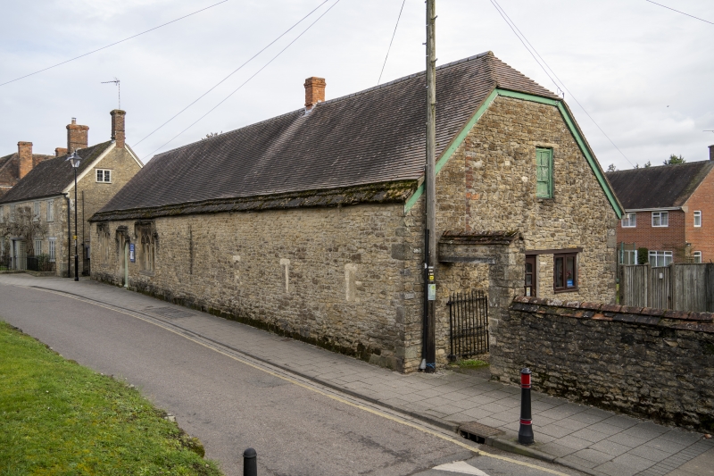
Schoolroom, now hall, probably mid C19 though possibly incorporating earlier work. Coursed rubble. Tiled roof with stone slate verges, gabled left and half-hipped right. Brick Stack left of centre. Single storey, long range with two windows and door to left. Three-light square-headed windows with 'Perpendicular' tracery and returned labels. Between is a two-centred door in square surround with returned label. Studded C19 plank door. Two blocked loops right.
Listing NGR: ST8067526592
External links are from the relevant listing authority and, where applicable, Wikidata. Wikidata IDs may be related buildings as well as this specific building. If you want to add or update a link, you will need to do so by editing the Wikidata entry.


Other nearby listed buildings