Latitude: 50.7325 / 50°43'57"N
Longitude: -1.7739 / 1°46'26"W
OS Eastings: 416049
OS Northings: 92567
OS Grid: SZ160925
Mapcode National: GBR 55B.VR5
Mapcode Global: FRA 7754.NQK
Plus Code: 9C2WP6MG+2C
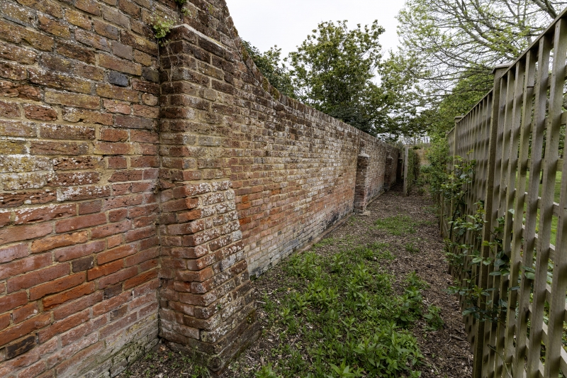
Entry Name: Boundary Wall to Garden of Rememberance in Christchurch Churchyard
Listing Date: 12 February 1976
Grade: II
Source: Historic England
Source ID: 1324653
English Heritage Legacy ID: 101491
ID on this website: 101324653
Location: Priory House, Wick, Bournemouth, Christchurch and Poole, Dorset, BH23
County: Bournemouth, Christchurch and Poole
Parish: Christchurch
Built-Up Area: Christchurch
Traditional County: Hampshire
Lieutenancy Area (Ceremonial County): Dorset
Church of England Parish: Christchurch Holy Trinity
Church of England Diocese: Winchester
Tagged with: Wall
CHURCH STREET 1. (South End) 5187 Boundary wall to Garden of Rememberance in Christchurch churchyard SZ 1592 1A/149
II GV
2. C18. Red brick wall, buttressed on inner side of lower north-eastern part and ramped in places.
Nos 10 to 13 (consec) (with its railings and wall), form a group with Nos 14 to 16 (consec) with associated wall and with the Priory Church, the gates to the churchyard, the sundial and boundary walls to churchyard and Garden of Rememberance.
Listing NGR: SZ1605092567
External links are from the relevant listing authority and, where applicable, Wikidata. Wikidata IDs may be related buildings as well as this specific building. If you want to add or update a link, you will need to do so by editing the Wikidata entry.


Other nearby listed buildings