Latitude: 50.3941 / 50°23'38"N
Longitude: -3.6646 / 3°39'52"W
OS Eastings: 281776
OS Northings: 56235
OS Grid: SX817562
Mapcode National: GBR QP.2L6X
Mapcode Global: FRA 3860.B4P
Plus Code: 9C2R98VP+J5
Entry Name: Maltster's Arms Public House
Listing Date: 26 April 1993
Grade: II
Source: Historic England
Source ID: 1324965
English Heritage Legacy ID: 100961
Also known as: The Maltsters Arms
ID on this website: 101324965
Location: Tuckenhay, South Hams, Devon, TQ9
County: Devon
District: South Hams
Civil Parish: Ashprington
Traditional County: Devon
Lieutenancy Area (Ceremonial County): Devon
Church of England Parish: Ashprington St David
Church of England Diocese: Exeter
Tagged with: Pub
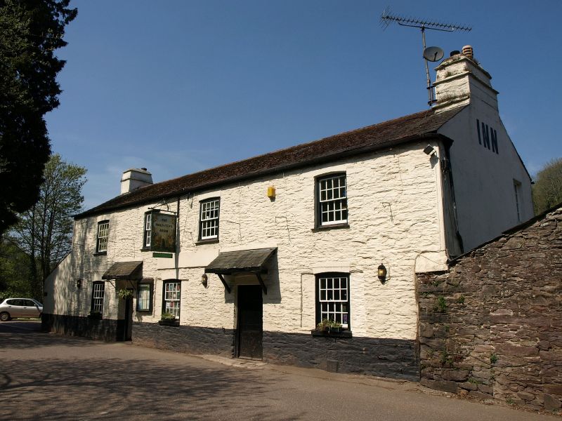
ASHPRINGTON SX85NW TUCKENAAM 6/52 Maltster's Arms Public House GV II Public house, possibly formerly 2 pairs of cottages. Circa early to mid C19 with C20 addition and internal alterations. Painted local stone rubble with rendered gable ends. Asbestos slate roof with gabled ends. Gable end stacks with tapered shafts with slate weathering. Plan: A long rectangular range that may originally have been 2 pairs of cottages; it is 2 storeys over 2 storeys of cellars which have access at the back onto the quay which is at a much lower level that the road at the front of the building. The internal plan of the ground floor of the 'house' has been entirely altered in the C20 to form bars to the public house and there is a C20 3-storey extension along the back of the building. Exterior: 2 storeys over 2 storeys of cellars. The road front is 2 storeys, symmetrical 4-window range with early to mid C19 16-pane sashes with segmented brick arches and slate sills. The first floor right hand window is now a 4- pane sash. The walls on either side of the ground floor windows are rebated to take the boarded window shutters. 2 doorways, a C19 6-panel door to left and right of centre, the lower panels flush, both have slated canopies, the right hand canopy is a replacement. Single storey lean-to outshut at the left hand end. C20 extensions across the back, stone ruble to the left and rendered to the right where the lower ground storey is open showing the back wall of the original building with its old cellar doorway. Interior: Only the ground floor was inspected; its plan has been entirely rearranged to form public house bars and a restaurant.
Listing NGR: SX8177656234
External links are from the relevant listing authority and, where applicable, Wikidata. Wikidata IDs may be related buildings as well as this specific building. If you want to add or update a link, you will need to do so by editing the Wikidata entry.


Other nearby listed buildings