Approximate Location Map
Large Map »
Latitude: 51.7544 / 51°45'15"N
Longitude: -1.2488 / 1°14'55"W
OS Eastings: 451949
OS Northings: 206456
OS Grid: SP519064
Mapcode National: GBR 8YY.WM4
Mapcode Global: VHCXV.95NF
Plus Code: 9C3WQQ32+QF
Entry Name: 19 and 20, Longwall Street
Listing Date: 28 June 1972
Grade: II
Source: Historic England
Source ID: 1325542
English Heritage Legacy ID: 245632
ID on this website: 101325542
Location: Oxford, Oxfordshire, OX1
County: Oxfordshire
District: Oxford
Electoral Ward/Division: Holywell
Parish: Non Civil Parish
Built-Up Area: Oxford
Traditional County: Oxfordshire
Lieutenancy Area (Ceremonial County): Oxfordshire
Church of England Parish: Oxford St Mary the Virgin with St Cross with St Peter-in-the-East,
Church of England Diocese: Oxford
Tagged with: Building
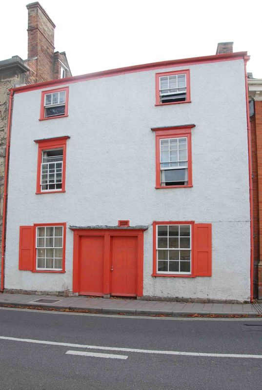
LONGWALL STREET
1.
1485
(West Side)
Nos 19 & 20
SP 5106 SE 9/388
II
2.
1 building. 3-storeyed C18 roughcast timber-framing. Welsh slate roof.
Brick stack. 2 C18-Cl9 sash windows in moulded wood frames and entablatures,
those on ground floor with shutters. The coupled doorways have moulded fluted
wood frames.
Listing NGR: SP5195106448
External links are from the relevant listing authority and, where applicable, Wikidata. Wikidata IDs may be related buildings as well as this specific building. If you want to add or update a link, you will need to do so by editing the Wikidata entry.


Other nearby listed buildings
