Latitude: 51.1439 / 51°8'38"N
Longitude: 0.686 / 0°41'9"E
OS Eastings: 587976
OS Northings: 141723
OS Grid: TQ879417
Mapcode National: GBR QVB.67S
Mapcode Global: VHJN2.VH0Y
Plus Code: 9F324MVP+H9
Entry Name: Vine Cottage
Listing Date: 10 October 1980
Grade: II
Source: Historic England
Source ID: 1325934
English Heritage Legacy ID: 181179
ID on this website: 101325934
Location: Smarden, Ashford, Kent, TN27
County: Kent
District: Ashford
Civil Parish: Smarden
Built-Up Area: Smarden
Traditional County: Kent
Lieutenancy Area (Ceremonial County): Kent
Tagged with: Cottage
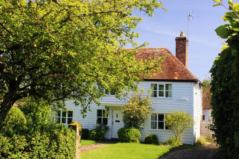
1.
5272 SMARDEN BETHERSDEN ROAD
Vine Cottage
TQ 3741 30/74
II
2.
C18. Two storeys faced with weatherboarding. Hipped tiled roof. Three casement
windows. Doorcase with wide flat hood on brackets.
Listing NGR: TQ8797641723
External links are from the relevant listing authority and, where applicable, Wikidata. Wikidata IDs may be related buildings as well as this specific building. If you want to add or update a link, you will need to do so by editing the Wikidata entry.


Other nearby listed buildings