Approximate Location Map
Large Map »
Latitude: 50.3321 / 50°19'55"N
Longitude: -4.7563 / 4°45'22"W
OS Eastings: 203932
OS Northings: 51654
OS Grid: SX039516
Mapcode National: GBR N1.XG2L
Mapcode Global: FRA 08X5.4TV
Plus Code: 9C2Q86JV+RF
Entry Name: 10, Quay Road
Listing Date: 11 March 1974
Grade: II
Source: Historic England
Source ID: 1327313
English Heritage Legacy ID: 70702
ID on this website: 101327313
Location: Charlestown, Cornwall, PL25
County: Cornwall
Civil Parish: St Austell Bay
Built-Up Area: St Austell
Traditional County: Cornwall
Lieutenancy Area (Ceremonial County): Cornwall
Church of England Parish: Charlestown
Church of England Diocese: Truro
Tagged with: Building
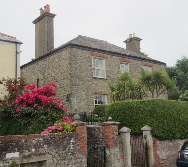
CHARLESTOWN
1. QUAY ROAD
1584A
No 10
SX 0351 NE 4/50
II GV
2.
Early C19 house. Stone rubble. 2 storeys. 3 windows red brick arches
sashes glazing bars exposed cases. Central wide door glazed pilastered
doorcase. Steep slate roof hipped. Rendered chimneys with moulded cornices.
Included for group value.
Nos 2 to 16 (consec) form a good group.
Listing NGR: SX0393251653
External links are from the relevant listing authority and, where applicable, Wikidata. Wikidata IDs may be related buildings as well as this specific building. If you want to add or update a link, you will need to do so by editing the Wikidata entry.


Other nearby listed buildings
