Approximate Location Map
Large Map »
Latitude: 50.1198 / 50°7'11"N
Longitude: -5.5349 / 5°32'5"W
OS Eastings: 147409
OS Northings: 30402
OS Grid: SW474304
Mapcode National: GBR DXQC.FHQ
Mapcode Global: VH12Z.07RZ
Plus Code: 9C2P4F98+W2
Entry Name: Raised Pavement, Steps and Railings
Listing Date: 29 July 1950
Grade: II
Source: Historic England
Source ID: 1327459
English Heritage Legacy ID: 69506
ID on this website: 101327459
Location: Penzance, Cornwall, TR18
County: Cornwall
Civil Parish: Penzance
Built-Up Area: Penzance
Traditional County: Cornwall
Lieutenancy Area (Ceremonial County): Cornwall
Church of England Parish: Penzance St John the Baptist
Church of England Diocese: Truro
Tagged with: Architectural structure
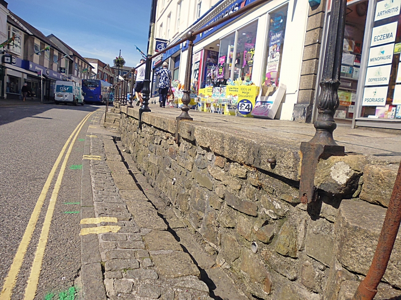
1.
1498 PENZANCE
MARKET JEW STREET
(North West Side)
Raised Pavement,
Steps and Railings
SW 475O 5/504
II
2.
C19. Raised pavement along north west side of Market Jew Street. Granite paving
stones Including iron railings with cast iron stanchions. And series of steps
up from road with iron railings.
Listing NGR: SW4751830582
External links are from the relevant listing authority and, where applicable, Wikidata. Wikidata IDs may be related buildings as well as this specific building. If you want to add or update a link, you will need to do so by editing the Wikidata entry.


Other nearby listed buildings
