Approximate Location Map
Large Map »
Latitude: 50.1196 / 50°7'10"N
Longitude: -5.5354 / 5°32'7"W
OS Eastings: 147372
OS Northings: 30373
OS Grid: SW473303
Mapcode National: GBR DXQC.F85
Mapcode Global: VH12Z.08H5
Plus Code: 9C2P4F97+RR
Entry Name: 13 and 14, Market Jew Street
Listing Date: 7 February 1974
Grade: II
Source: Historic England
Source ID: 1143978
English Heritage Legacy ID: 69509
ID on this website: 101143978
Location: Penzance, Cornwall, TR18
County: Cornwall
Civil Parish: Penzance
Built-Up Area: Penzance
Traditional County: Cornwall
Lieutenancy Area (Ceremonial County): Cornwall
Church of England Parish: Penzance St John the Baptist
Church of England Diocese: Truro
Tagged with: Building
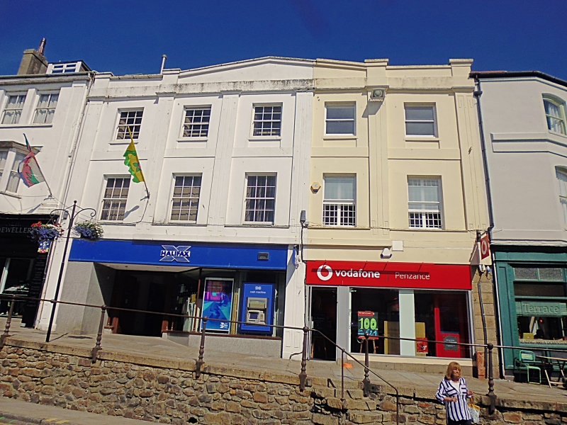
1.
1498 PENZANCE
MARKET JEW STREET
(North West Side)
Nos 13 and 14
SW 4730 5/50B
II GV
2.
Early C19. Stucco. Parapet treated as pediment over centre 3 windows, moulded
cornice. 1st and 2nd floor 6 scribed flat pilasters. 3 storeys. 5 windows.
Sashes with glazing bars. Ground floor, large modern shop fronts with incongrous
surrounds.
Nos 11 to 14 (consec) form a group.
Listing NGR: SW4737230373
External links are from the relevant listing authority and, where applicable, Wikidata. Wikidata IDs may be related buildings as well as this specific building. If you want to add or update a link, you will need to do so by editing the Wikidata entry.


Other nearby listed buildings
