Latitude: 50.2037 / 50°12'13"N
Longitude: -5.2692 / 5°16'9"W
OS Eastings: 166809
OS Northings: 38854
OS Grid: SW668388
Mapcode National: GBR Z0.TBY1
Mapcode Global: VH12Q.M47P
Plus Code: 9C2P6P3J+F8
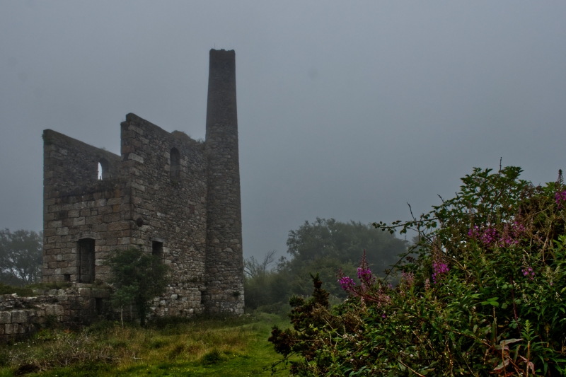
Entry Name: Fortescue's Shaft, South Engine House on Site of Grenville United North Mine
Listing Date: 16 March 1987
Grade: II
Source: Historic England
Source ID: 1328144
English Heritage Legacy ID: 66613
Also known as: Fortescue's Whim
Fortescues Whim
ID on this website: 101328144
Location: Treskillard, Cornwall, TR14
County: Cornwall
Civil Parish: Camborne
Traditional County: Cornwall
Lieutenancy Area (Ceremonial County): Cornwall
Church of England Parish: Treslothan
Church of England Diocese: Truro
Tagged with: Chimney Engine house
CAMBORNE NEWTON MOOR SW 63 NE 8/67 Fortescue's Shaft, South Engine House, on site of 16.3.87 Grenville United North Mine GV II
Winding engine house (or "whim") to former tin mine, now derelict. Probably late C19. Large granite rubble brought to courses, with quoins, bob wall of granite blocks, window arches of yellow brick, brick upper stage to chimney; now roofless. Rectangular plan on north-south axis, with bob wall to north, foundations of former winding drum in front of this, and circular chimney attached at south-west corner. Smaller building than the associated pump engine house, with 3 stages over a high plinth; narrow segmental-headed driver"s window in bob wall, round-headed cylinder door in rear wall, 2 round-headed windows above this, narrow doorway in west wall close to bob wall, a round-headed window at the top stage on this side, 2 round-headed windows to the 1st stage on the east side and one on each level above. Pair of plates to tie-rod through bob wall. Tapered cylindrical chimney with no cornice at the junction with the brick stage, which is damaged at the top. Foundations of winding drum partly dilapidated. Functional partner to pump engine house approx. 50 metres to the north (q.v.), forming an impressive group. History: one of a series of mines exploiting the Great Flat Lode. Ancient Monument No.873.
Listing NGR: SW6680938854
External links are from the relevant listing authority and, where applicable, Wikidata. Wikidata IDs may be related buildings as well as this specific building. If you want to add or update a link, you will need to do so by editing the Wikidata entry.


Other nearby listed buildings