Latitude: 52.2446 / 52°14'40"N
Longitude: 0.7139 / 0°42'49"E
OS Eastings: 585375
OS Northings: 264186
OS Grid: TL853641
Mapcode National: GBR QF0.792
Mapcode Global: VHKD4.BV74
Plus Code: 9F426PV7+VG
Entry Name: 47 and 48, Abbeygate Street
Listing Date: 7 August 1952
Grade: II
Source: Historic England
Source ID: 1328877
English Heritage Legacy ID: 466603
ID on this website: 101328877
Location: Bury St Edmunds, West Suffolk, IP33
County: Suffolk
District: West Suffolk
Civil Parish: Bury St Edmunds
Built-Up Area: Bury St Edmunds
Traditional County: Suffolk
Lieutenancy Area (Ceremonial County): Suffolk
Church of England Parish: Bury St Edmunds St Mary
Church of England Diocese: St.Edmundsbury and Ipswich
Tagged with: Building
BURY ST EDMUNDS
TL8564SW ABBEYGATE STREET 639-1/14/147 (South side) 07/08/52 Nos.47 AND 48
GV II
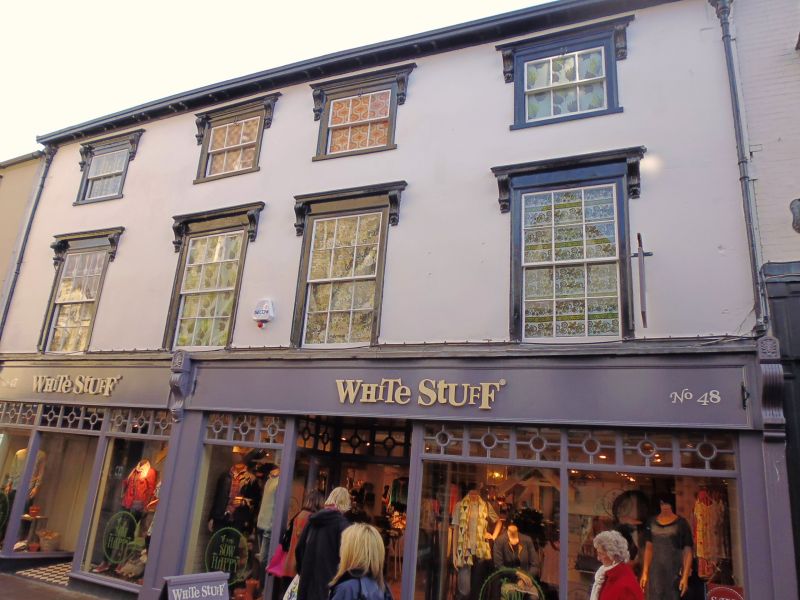
Shop, formerly 2 shops and houses. Early C19 front with a vestigial core of c1300; each half of the property has a long timber-framed rear range. Timber-framed and rendered; slate roof to front range, C20 tiles to rear. EXTERIOR: 3 storeys and cellar to front range, 2 storeys and part attics to rear. A paired bracketed eaves cornice to the front. 4 window range: small-paned sashes with wooden architraves and cornices on enriched console brackets. Late C20 shop fronts. INTERIOR: very fragmentary, with late C13/early C14 features, exposed during restoration in 1988, now removed or concealed again. The timber-framed east boundary wall with No.46 (qv), although hidden, is still substantially complete, with passing braces and scissor braces, and the associated structure of No.47 was initially jettied along the street frontage and contained a shop and a wide passage leading to a hall at the rear. The jetty structure and the bressumer survive. The rear range, difficult to analyze in its present form, has a C15 core and retains a coupled rafter roof (information from P Aitkens). The front was raised in the early C19 and the remodelled 1st storey room has a small ornate plaster cornice with bead and reel decoration. The west party wall to the front range of No.48, now also concealed, is of medieval flint rubble, and the long rear range is in several sections, part C16, part C17, the most northerly with the remains of a plain crown-post roof and the upper framing of an end wall surviving; to the south of this wall, an early C17 range with its upper west wall covered in square Jacobean panelling, including several re-set panels with guilloche or lozenge designs. In the ground storey rear, facing onto the former garden, a wide early C19 bow window has 3 small-paned sashes divided by reeded pilasters above a panelled dado. At the rear, a C16 timber-framed outbuilding, formerly detached, but now linked by a C20 extension to No.47, is in 2 bays with a chimney-stack at the south side. Heavy plain flat joists to the ground storey ceiling; timber lintel to fireplace; roof apparently C18 renewed. This seems to have been used as a kitchen or brewhouse. Thought to have been the capital messuage of John of
Nottingham (d.1437).
Listing NGR: TL8537564186
External links are from the relevant listing authority and, where applicable, Wikidata. Wikidata IDs may be related buildings as well as this specific building. If you want to add or update a link, you will need to do so by editing the Wikidata entry.


Other nearby listed buildings