Latitude: 54.569 / 54°34'8"N
Longitude: -1.3185 / 1°19'6"W
OS Eastings: 444158
OS Northings: 519517
OS Grid: NZ441195
Mapcode National: GBR MH7L.BY
Mapcode Global: WHD6Y.QFB6
Plus Code: 9C6WHM9J+HH
Entry Name: Stockton Railway Station
Listing Date: 11 January 1989
Grade: II
Source: Historic England
Source ID: 1329515
English Heritage Legacy ID: 59671
Also known as: Stockton Station
STK
ID on this website: 101329515
Location: Queen's Park, Stockton-on-Tees, North Yorkshire, TS18
County: Stockton-on-Tees
Electoral Ward/Division: Stockton Town Centre
Parish: Non Civil Parish
Built-Up Area: Stockton-on-Tees
Traditional County: Durham
Lieutenancy Area (Ceremonial County): County Durham
Church of England Parish: Stockton-on-Tees
Church of England Diocese: Durham
Tagged with: Railway station
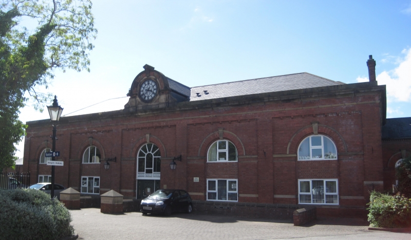
STOCKTON ON TEES BISHOPTON LANE NZ 4419 (north side) 25/1A Stockton Railway Station GV II Railway Station. 1893 By William Bell. Built by the North Eastern Railway Company. Red brick with ashlar dressings and slate roofs with 2 lateral and 6 ridge stacks. Chamfered ashlar plinth, plain cill band, moulded impost band, and moulded and chamfered eaves. Main east elevation has 2 storey central section with 5 bay single storey entrance porch articulated by 5 round arched openings with moulded keystones, and similar segmental arches to the side elevations. To the left a 3 bay section with 2 boarded doorways, and a former window, filled with glass bricks. To the right a single storey wing with a slightly projecting 5 bay central section with a central blocked, round headed doorway, with eitherside 2 round headed casements. Beyond again 2 similar windows eitherside, and beyond to left a slightly projecting section with 2 similar windows. To the right a 4 bay wing set at right angles with 4 round arches all with glazing bar fanlights. The platform elevation is articulated with round arches and defining pilasters with a central pair of arches flanked by single arches, flanked by 3 pairs of arches and finally a single arch and nominating piers. This facade has a large clock supported on an ornate iron bracket. To the west a set back retaining wall, with a single storey wooden office building in front. This building was originally linked to the retaining wall to the west (qv) by a large iron roof, which was removed in 1978.
Listing NGR: NZ4415819517
External links are from the relevant listing authority and, where applicable, Wikidata. Wikidata IDs may be related buildings as well as this specific building. If you want to add or update a link, you will need to do so by editing the Wikidata entry.


Other nearby listed buildings