Approximate Location Map
Large Map »
Latitude: 53.2832 / 53°16'59"N
Longitude: -2.2371 / 2°14'13"W
OS Eastings: 384291
OS Northings: 376278
OS Grid: SJ842762
Mapcode National: GBR DZTG.GR
Mapcode Global: WHBBF.LQYV
Plus Code: 9C5V7QM7+75
Entry Name: Corner Pier and Garden Wall to South West of the Old Hall
Listing Date: 6 July 1984
Grade: II
Source: Historic England
Source ID: 1329658
English Heritage Legacy ID: 58296
ID on this website: 101329658
Location: Nether Alderley, Cheshire East, Cheshire, SK10
County: Cheshire East
Civil Parish: Nether Alderley
Traditional County: Cheshire
Lieutenancy Area (Ceremonial County): Cheshire
Church of England Parish: Alderley St Mary
Church of England Diocese: Chester
Tagged with: Architectural structure
SJ 87 NW
4/129
NETHER ALDERLEY C.P.
CONGLETON ROAD
(East Side)
Corner pier and garden wall to south-west of the Old Hall.
II
GV
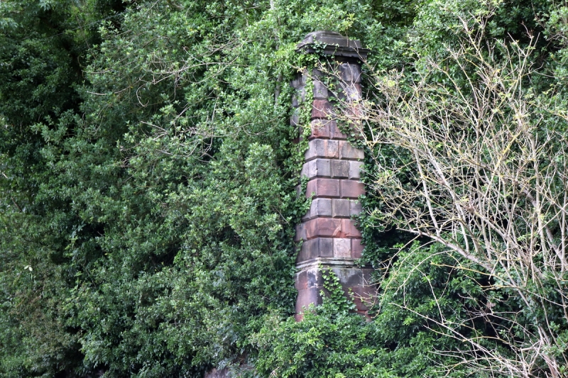
Corner pier and garden wall: partly C17, partly mid C18. Ashlar buff
sandstone and some English garden wall bond red brick. Chamfered
rusticated gate pier on moulded plinth with a projecting moulded
capstone and a stepped top. The pier stands on the corner of the
stone garden wall on Congleton Road. The pier is ivy clad and is said
to have the Stanley crest. For 15m north and to the east is the
original stone garden wall. To the east this changes to a C17 brick
wall with stone coping. Where it joins the Mill dam wall is a small
gate, with a truncated stone pier, T-shape in plan with
ovolo-mouldings on the corner.
These are the remains of grand gardens, walls and bridges that were in
front of the major extensions of the Old Hall built in 1754 by Sir
Edward Stanley, destroyed by fire in 1779 and subsequently demolished.
Listed for group value only.
Listing NGR: SJ 84291 76278
External links are from the relevant listing authority and, where applicable, Wikidata. Wikidata IDs may be related buildings as well as this specific building. If you want to add or update a link, you will need to do so by editing the Wikidata entry.


Other nearby listed buildings
