Latitude: 53.097 / 53°5'49"N
Longitude: -2.4438 / 2°26'37"W
OS Eastings: 370379
OS Northings: 355630
OS Grid: SJ703556
Mapcode National: GBR 7X.8T21
Mapcode Global: WH9B5.FFJ2
Plus Code: 9C5V3HW4+RF
Entry Name: 1-9, Tollitt Street
Listing Date: 29 March 1976
Last Amended: 14 June 1984
Grade: II
Source: Historic England
Source ID: 1330052
English Heritage Legacy ID: 56700
ID on this website: 101330052
Location: Crewe, Cheshire East, Cheshire, CW1
County: Cheshire East
Civil Parish: Crewe
Built-Up Area: Crewe
Traditional County: Cheshire
Lieutenancy Area (Ceremonial County): Cheshire
Church of England Parish: Crewe St Andrew
Church of England Diocese: Chester
Tagged with: Building
SJ 75 NW FORMER BOROUGH OF CREWE TOLLITT STREET
2/57 Nos.1 to 9 (consecutive) [formerly listed as Nos 1 to 10 29.3.76 (consec)]
GV II
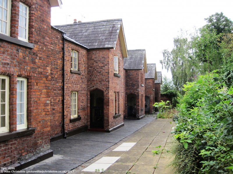
Terrace of 9 cottages, circa 1848, by John Cunningham, as part of Engineer Joseph Locke's original layout for the Grand Junction Railway Company; now private dwellings. Brown brick with slate roofs, 2 storeys, 2 bays each off stone plinth. Built in handed pairs with Tudor arched entrance porches on either side of projecting gable. Original entrance doors replaced by multi-panel doors. Single light casements in porch gables, two light horizontally sliding sashes elsewhere, all with stone sills and flat chamfered arches. Small blank sunken panel, with chamfered surround, in porch gable apex, and slightly shaped narrow barge board. Eaves gutter on moulded fascia, lead valleys, four-flue party wall stacks and blue tile ridges. Nos.1 to 19 (odd) and Nos.2 to 20 (even) Betley Street and Nos.1 to 19 (odd) and Nos.2 to 20 (even) Dorfold Street (q.q.v.) were built as part of the same development.
Listing NGR: SJ7037955630
External links are from the relevant listing authority and, where applicable, Wikidata. Wikidata IDs may be related buildings as well as this specific building. If you want to add or update a link, you will need to do so by editing the Wikidata entry.


Other nearby listed buildings