Approximate Location Map
Large Map »
Latitude: 53.2522 / 53°15'8"N
Longitude: -2.8628 / 2°51'45"W
OS Eastings: 342532
OS Northings: 373149
OS Grid: SJ425731
Mapcode National: GBR 8ZGT.0W
Mapcode Global: WH882.0J14
Plus Code: 9C5V742P+VV
Entry Name: Stoak Bridge (137)
Listing Date: 17 June 1982
Grade: II
Source: Historic England
Source ID: 1330239
English Heritage Legacy ID: 55424
ID on this website: 101330239
Location: Stoak, Cheshire West and Chester, Cheshire, CH2
County: Cheshire West and Chester
Civil Parish: Stoak
Traditional County: Cheshire
Lieutenancy Area (Ceremonial County): Cheshire
Church of England Parish: Ellesmere Port Team
Church of England Diocese: Chester
Tagged with: Bridge
SJ 47SW .
4/41
17.6.82
STOAK C.P
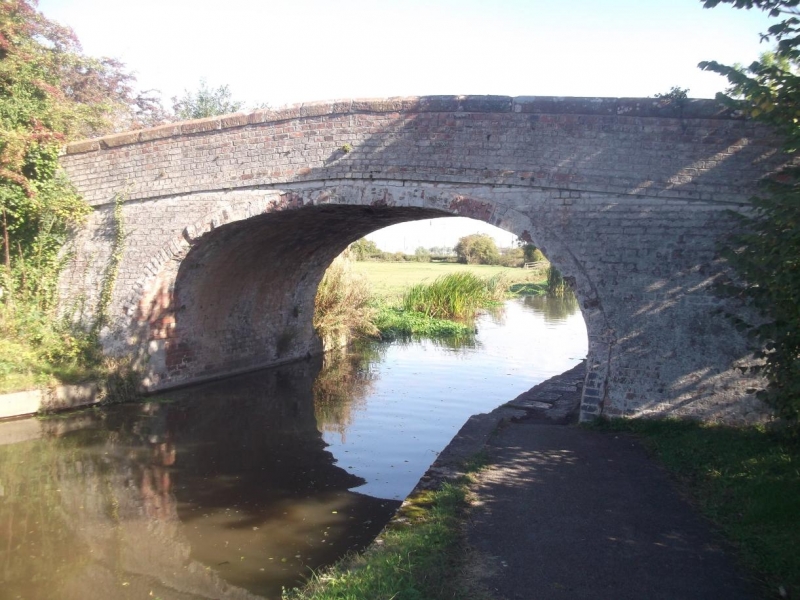
Stoak Bridge (137)
II
Bridge, c1795, over the Shropshire Union (Ellesmere) Canal. Of the
canal company's standard design for minor road bridges. Brown brick
English band. Arch of slightly more than semi-ellipse. 2-course
plain brick band at road level. Plain near-flush sandstone coping on
parapet. Abutments have marked batter. Carrying footpath and farm
traffic.
Listing NGR: SJ 42532 73149
External links are from the relevant listing authority and, where applicable, Wikidata. Wikidata IDs may be related buildings as well as this specific building. If you want to add or update a link, you will need to do so by editing the Wikidata entry.


Other nearby listed buildings
