Latitude: 53.1614 / 53°9'41"N
Longitude: -2.2115 / 2°12'41"W
OS Eastings: 385952
OS Northings: 362722
OS Grid: SJ859627
Mapcode National: GBR 12B.ZMH
Mapcode Global: WHBC1.0S5R
Plus Code: 9C5V5Q6Q+H9
Entry Name: Paved Area of Cockshuts on South and West Sides of St Peters Churchyard
Listing Date: 4 April 1975
Grade: II
Source: Historic England
Source ID: 1330324
English Heritage Legacy ID: 55870
ID on this website: 101330324
Location: Congleton, Cheshire East, Cheshire, CW12
County: Cheshire East
Civil Parish: Congleton
Built-Up Area: Congleton
Traditional County: Cheshire
Lieutenancy Area (Ceremonial County): Cheshire
Church of England Parish: Congleton Team
Church of England Diocese: Chester
Tagged with: Architectural structure Path
1.
5144 COCKSHUTS
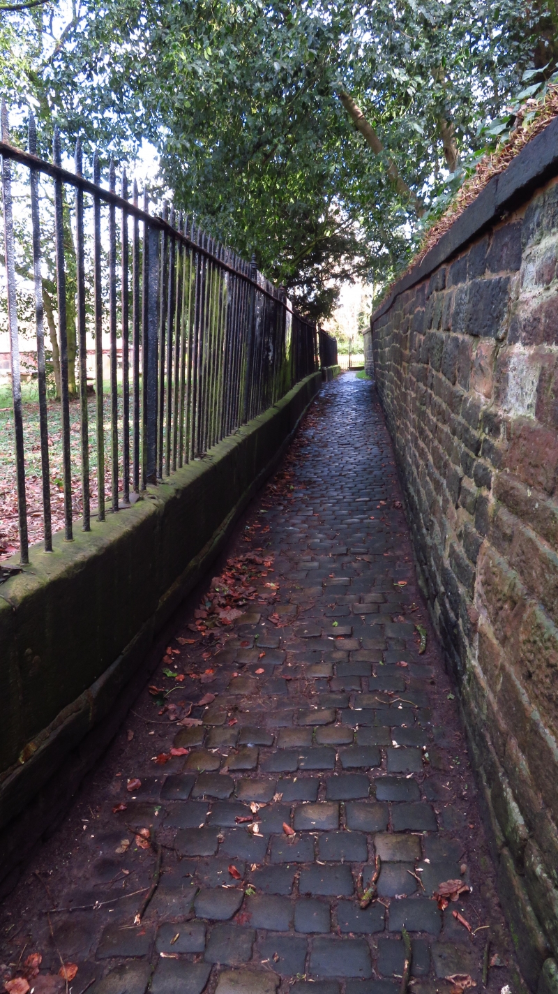
Paved area of Cockshuts
on south and west sides
of St Peter's Churchyard
SJ 8562 1/64
II GV
2.
Cockshuts is a narrow enclosed pathway running from Chapel Street at the west side
of St Peter's Churchyard to Canal Street. The paved area is of granite setts.
Paved area of Cockshuts forms a group with Nos 2 to 8 (even),
St Peter's Church, Gatepiers, Gates and Railings of St Peter's
Church.
The group value note appearing against the entries for Nos 2 and 4, No 6, and No 8
Chapel Street, and the Church of St Peter, and the Gate piers, gates and railings
of St Peter's Churchyard, Chapel Street should be amended to read:
Nos 2 to 8 (even), St Peter's Church, and the gate piers, gates and
railings of St Peter's Churchyard form a group.
---------------------------------------------
1.
5144 COCKSHUTS
Paved area of Cockshuts
on south end west sides
of St. Peter' Churchyard
SJ 8562 1/64
IT GV
2.
Cockshuts is a narrow enclosed pathway running from Chapel Street at the
west side of St Peter's Churchyard to Canal Street. The paved area is
of granite setts.
Paved area of Cockshuts forms a group woth Nos 2 to 8 (even).St Peters
Church.Gatepiers. Gates and Railings of St Peter's Church.
Listing NGR: SJ8595262722
External links are from the relevant listing authority and, where applicable, Wikidata. Wikidata IDs may be related buildings as well as this specific building. If you want to add or update a link, you will need to do so by editing the Wikidata entry.


Other nearby listed buildings