Latitude: 53.1286 / 53°7'42"N
Longitude: -2.6934 / 2°41'36"W
OS Eastings: 353700
OS Northings: 359267
OS Grid: SJ537592
Mapcode National: GBR 7L.6S9V
Mapcode Global: WH88Q.LMNF
Plus Code: 9C5V48H4+CJ
Entry Name: Walls, Towers and Gatehouse of the Inner Bailey at Beeston Castle
Listing Date: 1 March 1967
Last Amended: 3 April 1986
Grade: I
Source: Historic England
Source ID: 1330329
English Heritage Legacy ID: 55798
ID on this website: 101330329
Location: Beeston, Cheshire West and Chester, Cheshire, CW6
County: Cheshire West and Chester
Civil Parish: Beeston
Traditional County: Cheshire
Lieutenancy Area (Ceremonial County): Cheshire
Church of England Parish: Bunbury St Boniface
Church of England Diocese: Chester
SJ 55 NW BEESTON C.P. (Off) CASTLE ROAD
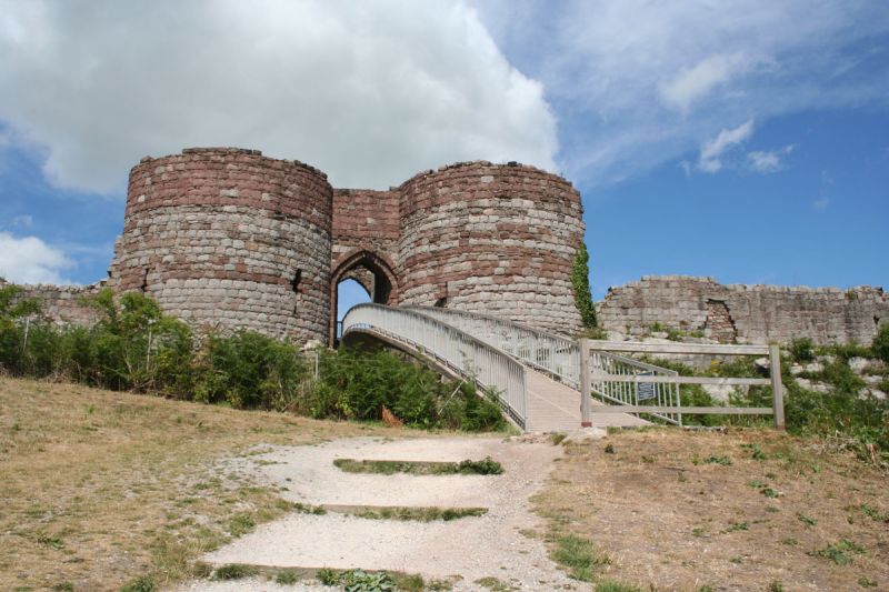
5/8 Walls, towers and gatehouse of the Inner 1.3.67 Bailey at Beeston Castle. (Formerly listed as Beeston Castle) GV I Walls, gatehouse and towers of inner bailey. c1220 altered late C13/early C14. Built by Ranulf de Blundeville, 7th Earl of Chester. Crudely coursed red sandstone. Roughly rectangular enclosure of which approximately half is now demolished. Entrance front: central gateway with D-shaped towers with lateral arrow slits and central pointed gate-arch with rebate. The left-hand turret has the voussoirs of a blocked pointed arch to the lower wall. To the left is curtain walling with the lower courses of a further D-shaped tower. To the right is a similar stretch of walling roughly repaired with rubble at its centre with a D-shaped tower slightly to the left of the right hand corner. The right hand (eastern) wall has a similar D-shaped tower to the centre of the wall.
On the death of Ranulf de Blundeville's nephew the castle passed to the Crown. In the late C13 and early C14 Edward I carried out modernising alterations including raising the height of the inner bailey walls and crenellating them. By the late C16 Leland described the castle as "shattered and ruinous". In 1643 it was partially repaired and occupied by parliamentary troops and taken by Royalist forces in the same year. It was partially demolished in 1646 to prevent its repeated use as a stronghold. Archaeological evidence of Bronze and Iron age settlements on the site has been found.
Listing NGR: SJ5370659267
External links are from the relevant listing authority and, where applicable, Wikidata. Wikidata IDs may be related buildings as well as this specific building. If you want to add or update a link, you will need to do so by editing the Wikidata entry.


Other nearby listed buildings