Latitude: 52.3174 / 52°19'2"N
Longitude: -0.0362 / 0°2'10"W
OS Eastings: 533955
OS Northings: 270628
OS Grid: TL339706
Mapcode National: GBR K4D.PNB
Mapcode Global: VHGM5.B07S
Plus Code: 9C4X8X87+XG
Entry Name: Hill Farmhouse
Listing Date: 16 August 1971
Grade: II
Source: Historic England
Source ID: 1330791
English Heritage Legacy ID: 54059
ID on this website: 101330791
Location: Holywell, Huntingdonshire, Cambridgeshire, PE27
County: Cambridgeshire
District: Huntingdonshire
Civil Parish: Holywell-cum-Needingworth
Built-Up Area: Holywell
Traditional County: Huntingdonshire
Lieutenancy Area (Ceremonial County): Cambridgeshire
Church of England Parish: Holywell St John the Baptist
Church of England Diocese: Ely
Tagged with: Farmhouse Thatched farmhouse
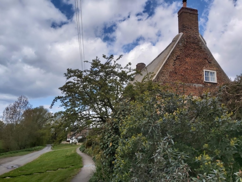
HOLYWELL-CUM-NEEDINGWORTH HOLYWELL FRONT 1. 5140 Holywell TL 37 SW 7/30 16.8.71 Hill Farmhouse II GV 2. Farmhouse dated 1623 in plastered panel on left hand stack. T-plan, two-storeys with single-storey range to left hand. Thatched roofs. Left hand stack with moulded brick cornice and engaged diagonal shafts of local red brick. Similar brick in kneed parapet gable wall with plain stack to right hand. Timber-frame of three bays cased in gault brick. Two first-floor horizontal sliding sash windows with glazing bars. Two casement windows with glazing bars in segmental arches flank central door and open porch. Interior has stop chamfered ceiling beams. Two inglenook hearths, one to right hand semi-elliptical in plan. Stair beside stack at first-floor to garret. (RCHM Huntingdonshire Mon 7 p 142).
Listing NGR: TL3395570628
External links are from the relevant listing authority and, where applicable, Wikidata. Wikidata IDs may be related buildings as well as this specific building. If you want to add or update a link, you will need to do so by editing the Wikidata entry.


Other nearby listed buildings