Latitude: 52.5654 / 52°33'55"N
Longitude: -0.2501 / 0°15'0"W
OS Eastings: 518708
OS Northings: 297839
OS Grid: TL187978
Mapcode National: GBR HZW.3LC
Mapcode Global: WHHNK.4S54
Plus Code: 9C4XHP8X+5X
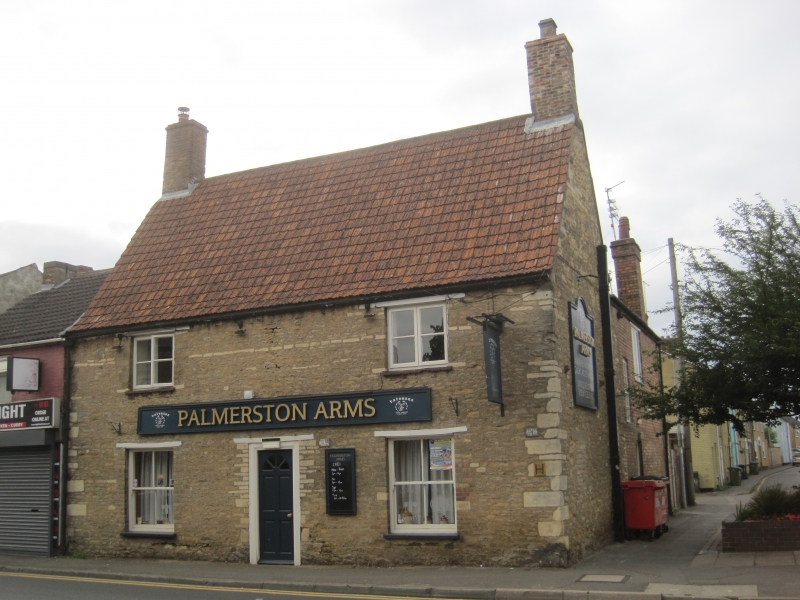
Entry Name: Palmerston Arms Public House
Listing Date: 7 May 1973
Grade: II
Source: Historic England
Source ID: 1331491
English Heritage Legacy ID: 49629
ID on this website: 101331491
Location: New Fletton, Peterborough, Cambridgeshire, PE2
County: City of Peterborough
Electoral Ward/Division: Fletton and Woodston
Parish: Non Civil Parish
Built-Up Area: Peterborough
Traditional County: Huntingdonshire
Lieutenancy Area (Ceremonial County): Cambridgeshire
Church of England Parish: Woodston St Augustine of Canterbury
Church of England Diocese: Ely
Tagged with: Pub
PETERBOROUGH 1. 1500 OUNDIE ROAD (South Side) Palmerson Arms Public House TL 1897 7/40 II 2. C18. Two storeys in coursed rubble with stone quotas. Steep pantile roof with brick chimneys at gable ends. Two windows, casements with wood lintels. On the ground floor, two windows and one door, wood lintels.
Listing NGR: TL1870897839
External links are from the relevant listing authority and, where applicable, Wikidata. Wikidata IDs may be related buildings as well as this specific building. If you want to add or update a link, you will need to do so by editing the Wikidata entry.


Other nearby listed buildings