Approximate Location Map
Large Map »
Latitude: 52.0873 / 52°5'14"N
Longitude: -0.7198 / 0°43'11"W
OS Eastings: 487809
OS Northings: 243988
OS Grid: SP878439
Mapcode National: GBR CZR.4TT
Mapcode Global: VHDSV.GSTR
Plus Code: 9C4X37PJ+W3
Entry Name: Revis's Almshouses
Listing Date: 7 July 1972
Grade: II
Source: Historic England
Source ID: 1332208
English Heritage Legacy ID: 45297
ID on this website: 101332208
Location: Newport Pagnell, Milton Keynes, Buckinghamshire, MK16
County: Milton Keynes
Civil Parish: Newport Pagnell
Built-Up Area: Newport Pagnell
Traditional County: Buckinghamshire
Lieutenancy Area (Ceremonial County): Buckinghamshire
Church of England Parish: Newport Pagnell
Church of England Diocese: Oxford
Tagged with: Almshouse
CHURCH PASSAGE
1.
1446
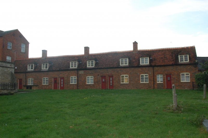
Revis's Almshouses
[Nos 1 to 4 (consec)]
X2 1/65
II
2.
1763 on central stone tablet. Recently restored. Red bricks, old tiled
roof, 1 storey and attics, 7 hipped casement dormers, 8 casements under
cambered arches.
Listing NGR: SP8781743993
External links are from the relevant listing authority and, where applicable, Wikidata. Wikidata IDs may be related buildings as well as this specific building. If you want to add or update a link, you will need to do so by editing the Wikidata entry.


Other nearby listed buildings
