Approximate Location Map
Large Map »
Latitude: 51.6295 / 51°37'46"N
Longitude: -0.7506 / 0°45'2"W
OS Eastings: 486578
OS Northings: 193037
OS Grid: SU865930
Mapcode National: GBR D54.WJV
Mapcode Global: VHDW4.Y92N
Plus Code: 9C3XJ6HX+QQ
Entry Name: The Antelope Public House
Listing Date: 28 June 1973
Grade: II
Source: Historic England
Source ID: 1332346
English Heritage Legacy ID: 45995
ID on this website: 101332346
Location: High Wycombe, Buckinghamshire, HP11
County: Buckinghamshire
Electoral Ward/Division: Abbey
Parish: Non Civil Parish
Built-Up Area: High Wycombe
Traditional County: Buckinghamshire
Lieutenancy Area (Ceremonial County): Buckinghamshire
Church of England Parish: High Wycombe All Saints
Church of England Diocese: Oxford
Tagged with: Pub
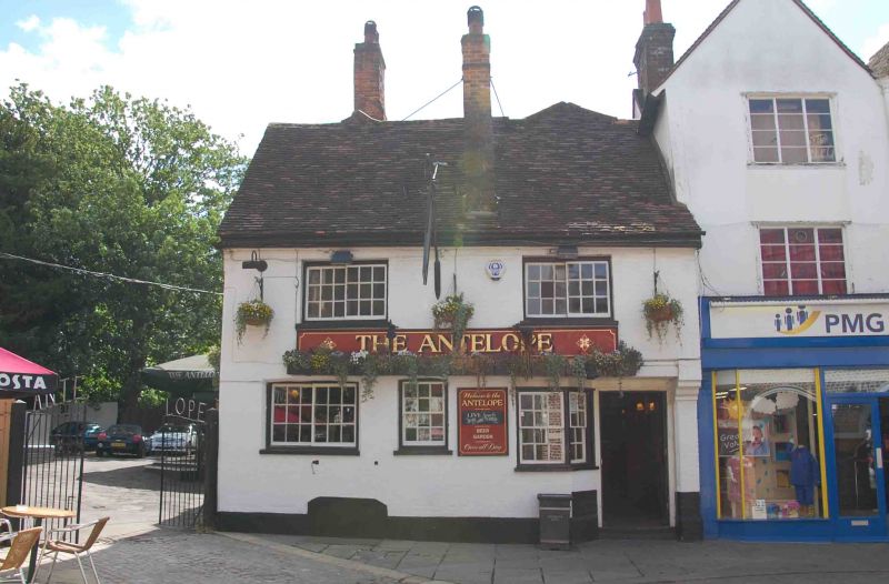
CHURCH SQUARE
1.
963
The Antelope Public House
SU 8693 SE 2/22
II GV
2.
Early C19 refronting of C17 building. Colour washed brick, old tiled roof
with boxed eaves. 2 storeys, 2 Yorkshire casements with glazing bars on
1st floor. Ground floor has similar casement window on left hand, later
sash window in centre, right hand recessed wedged door with a coupled sash
window on corner.
Church of All Saints, Churchyard Gates together with No 2, The Antelope
Public House, No 5 and No 6 form a group with Nos 1 to 3 (consec) High
Street.
Listing NGR: SU8658593032
External links are from the relevant listing authority and, where applicable, Wikidata. Wikidata IDs may be related buildings as well as this specific building. If you want to add or update a link, you will need to do so by editing the Wikidata entry.


Other nearby listed buildings
