Latitude: 51.6421 / 51°38'31"N
Longitude: -0.7985 / 0°47'54"W
OS Eastings: 483235
OS Northings: 194384
OS Grid: SU832943
Mapcode National: GBR D4W.WG5
Mapcode Global: VHDVY.3ZQJ
Plus Code: 9C3XJ6R2+RH
Entry Name: The Cascade West Wycombe Park
Listing Date: 28 June 1973
Grade: II
Source: Historic England
Source ID: 1332415
English Heritage Legacy ID: 46171
ID on this website: 101332415
Location: West Wycombe, Buckinghamshire, HP14
County: Buckinghamshire
Civil Parish: West Wycombe
Traditional County: Buckinghamshire
Lieutenancy Area (Ceremonial County): Buckinghamshire
Church of England Parish: West Wycombe
Church of England Diocese: Oxford
Tagged with: Architectural structure
WEST WYCOMBE 1. 963 The Cascade, West Wycombe Park SU 8394 10/330 II
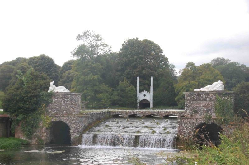
2. C18 with C20 alterations and additions. A print of 1757 shows a triple cascade under an arch of artificial rocks. Now with 5 segmental brick arches flint faced with keystones, brick bands, ashlar copings. 2 C20 pedestals either side with reclining female figures in fibre glass imitating lead.
Listing NGR: SU8323594384
External links are from the relevant listing authority and, where applicable, Wikidata. Wikidata IDs may be related buildings as well as this specific building. If you want to add or update a link, you will need to do so by editing the Wikidata entry.


Other nearby listed buildings