Approximate Location Map
Large Map »
Latitude: 50.7838 / 50°47'1"N
Longitude: -3.0016 / 3°0'5"W
OS Eastings: 329486
OS Northings: 98722
OS Grid: SY294987
Mapcode National: GBR M5.ZWYC
Mapcode Global: FRA 47L0.QFN
Plus Code: 9C2RQXMX+G9
Entry Name: Stoney Bridge
Listing Date: 6 June 1983
Grade: II
Source: Historic England
Source ID: 1333491
English Heritage Legacy ID: 87604
ID on this website: 101333491
Location: Axminster, East Devon, EX13
County: Devon
District: East Devon
Civil Parish: Axminster
Built-Up Area: Axminster
Traditional County: Devon
Lieutenancy Area (Ceremonial County): Devon
Church of England Parish: Axminster St Mary
Church of England Diocese: Exeter
Tagged with: Bridge
SY 29 98 AXMINSTER CASTLE HILL
1/9
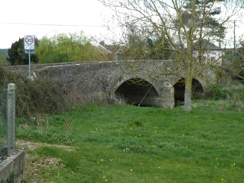
Stoney Bridge
II
Circa late C18 or early C19 stone rubble road bridge over River Axe. Two
semi-circular arches. Low cutwaters each side with set-offs. Parapet curved at ends
and with stone coping.
Listing NGR: SY2948698722
External links are from the relevant listing authority and, where applicable, Wikidata. Wikidata IDs may be related buildings as well as this specific building. If you want to add or update a link, you will need to do so by editing the Wikidata entry.


Other nearby listed buildings
