Latitude: 52.7806 / 52°46'50"N
Longitude: -1.6459 / 1°38'45"W
OS Eastings: 423978
OS Northings: 320389
OS Grid: SK239203
Mapcode National: GBR 5F1.QPB
Mapcode Global: WHCGC.PCFP
Plus Code: 9C4WQ9J3+6J
Entry Name: Sunken Gardens at Site of Drakelow Hall
Listing Date: 12 December 1986
Grade: II
Source: Historic England
Source ID: 1334614
English Heritage Legacy ID: 82950
ID on this website: 101334614
Location: South Derbyshire, DE15
County: Derbyshire
District: South Derbyshire
Town: South Derbyshire
Civil Parish: Drakelow
Built-Up Area: Burton upon Trent
Traditional County: Derbyshire
Lieutenancy Area (Ceremonial County): Staffordshire
Church of England Parish: Linton and Castle Gresley Christ Church
Church of England Diocese: Derby
Tagged with: Architectural structure
SK 22 SW PARISH OF DRAKELOW WALTON ROAD 1/18 (North Side) Sunken Gardens at Site of Drakelow Hall GV II
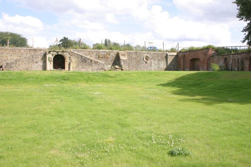
Sunken garden walls and terraces. 1902 by Reginald Blomfield for Robert Gresley of Drakelow Hall. Brick and ashlar. Rectangular plan with River Trent to north side and raised terraces to other three sides. Central ashlar pavilion to south side with moulded semi-circular arch plus large double keystone flanked by attached Tuscan columns. Pavilion has balcony to top with flight of steps to either side. Vase balustrade now mostly missing. Inside the pavilion is a plaque inscribed 'Robert Gresley 11th Baronet built these terrace AD 1902 as a monument to the memory of his beloved mother, Laura, Lady Gresley'. Attached to either side of the pavilion there are high rubble retaining walls with moulded circular niches on moulded stone brackets, and rusticated buttresses. East and west retaining walls are of brick and have large segment headed recesses to south end and a series of oval brick niches on brick corbels to north. Beyond to north at a lower level, there are rusticated semi-circular headed brick archways with large double keystones, which lead out of the garden. The short walls to either side, have bands of tile hanging. The northern ends of the terraces each have a brick retaining wall with a semi-circular headed arch of alternating coloured bricks enclosing a small semi- circular headed niche. Drakelow Hall was demolished in 1934 and Drakelow Power Station now occupies most of the site.
Listing NGR: SK2397820389
External links are from the relevant listing authority and, where applicable, Wikidata. Wikidata IDs may be related buildings as well as this specific building. If you want to add or update a link, you will need to do so by editing the Wikidata entry.


Other nearby listed buildings