Approximate Location Map
Large Map »
Latitude: 54.3812 / 54°22'52"N
Longitude: -2.8171 / 2°49'1"W
OS Eastings: 347027
OS Northings: 498722
OS Grid: SD470987
Mapcode National: GBR 8KRS.X6
Mapcode Global: WH82N.P4QM
Plus Code: 9C6V95JM+F5
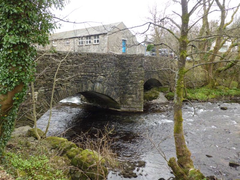
Entry Name: Barley Bridge over the River Kent
Listing Date: 12 February 1962
Grade: II
Source: Historic England
Source ID: 1336082
English Heritage Legacy ID: 76489
ID on this website: 101336082
Location: Staveley, Westmorland and Furness, Cumbria, LA8
County: Cumbria
District: South Lakeland
Civil Parish: Over Staveley
Built-Up Area: Staveley
Traditional County: Westmorland
Lieutenancy Area (Ceremonial County): Cumbria
Church of England Parish: Staveley St James
Church of England Diocese: Carlisle
Tagged with: Bridge
SD 49 NE OVER STAVELEY Staveley
6/28 Barley Bridge over
12/2/62 the River Kent
G.V. II
Bridge. Date uncertain. Possibly C17. North side partly rebuilt during C20:
in keeping. Slate rubble. Approximately 8' wide. 2 segmental arches;
cutwaters to central pier; pedestrian refuge over Northern cutwater.
References: RCHM p.219; Jervoise p.124.
Listing NGR: SD4702798722
External links are from the relevant listing authority and, where applicable, Wikidata. Wikidata IDs may be related buildings as well as this specific building. If you want to add or update a link, you will need to do so by editing the Wikidata entry.


Other nearby listed buildings
