Latitude: 51.2711 / 51°16'16"N
Longitude: 0.5165 / 0°30'59"E
OS Eastings: 575637
OS Northings: 155449
OS Grid: TQ756554
Mapcode National: GBR PR6.CC7
Mapcode Global: VHJMD.W9XX
Plus Code: 9F327GC8+CH
Entry Name: 21, the Broadway
Listing Date: 2 August 1974
Grade: II
Source: Historic England
Source ID: 1336160
English Heritage Legacy ID: 173260
ID on this website: 101336160
Location: Maidstone, Kent, ME16
County: Kent
District: Maidstone
Electoral Ward/Division: Fant
Parish: Non Civil Parish
Built-Up Area: Maidstone
Traditional County: Kent
Lieutenancy Area (Ceremonial County): Kent
Tagged with: Building
THE BROADWAY 1. 5278 (South Side) TQ 7555 SE 6/133 No 21 II
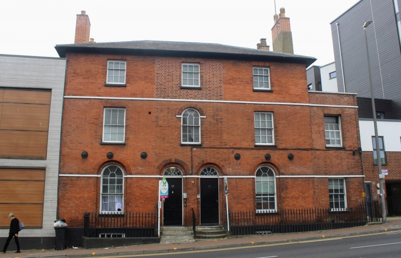
2. Originally a pair of houses of about 1830 built as one composition. 3 storeys red brick. Ripped slate roof and eaves cornice. Painted stringcourses above ground and lst floors. 3 sashes with most glazing bars intact. Round-headed windows on the ground floor and in the centre of the 1st floor. Round-headed recessed doorway set in arcading with semi-circular fanlights and 6 panelled doors. No 21 has a 2 storey extension in matching style with 1 sash.
Listing NGR: TQ7563755449
External links are from the relevant listing authority and, where applicable, Wikidata. Wikidata IDs may be related buildings as well as this specific building. If you want to add or update a link, you will need to do so by editing the Wikidata entry.


Other nearby listed buildings