Latitude: 51.2987 / 51°17'55"N
Longitude: 1.1191 / 1°7'8"E
OS Eastings: 617538
OS Northings: 160124
OS Grid: TR175601
Mapcode National: GBR TXY.FRS
Mapcode Global: VHLGG.BMZ9
Plus Code: 9F3374X9+FJ
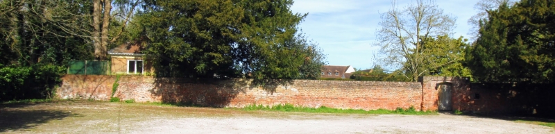
Entry Name: Garden Wall to Milner Court
Listing Date: 30 January 1967
Grade: II
Source: Historic England
Source ID: 1336611
English Heritage Legacy ID: 171462
ID on this website: 101336611
Location: Sturry, Canterbury, Kent, CT2
County: Kent
District: Canterbury
Civil Parish: Sturry
Built-Up Area: Sturry
Traditional County: Kent
Lieutenancy Area (Ceremonial County): Kent
Tagged with: Wall
1. 5273 STURRY MILNER LANE
Garden wall to Milner Court TR 1760 32/596B 30.1.67
II GV
2. C16 about 5 feet in height. The east wall bordering the churchyard has a series of 18 recesses with nearly square heads. The west wall bordering the garden of Milner Court is continued at right angles at the south end and at the north end where it reaches to the house.
Listing NGR: TR1753660123
External links are from the relevant listing authority and, where applicable, Wikidata. Wikidata IDs may be related buildings as well as this specific building. If you want to add or update a link, you will need to do so by editing the Wikidata entry.


Other nearby listed buildings