Approximate Location Map
Large Map »
Latitude: 51.2807 / 51°16'50"N
Longitude: 1.0785 / 1°4'42"E
OS Eastings: 614794
OS Northings: 158004
OS Grid: TR147580
Mapcode National: GBR TY2.PHQ
Mapcode Global: VHLGM.N21K
Plus Code: 9F3373JH+7C
Entry Name: 15, the Friars
Listing Date: 7 September 1973
Grade: II
Source: Historic England
Source ID: 1336841
English Heritage Legacy ID: 170618
ID on this website: 101336841
Location: Canterbury, Kent, CT1
County: Kent
District: Canterbury
Electoral Ward/Division: Westgate
Parish: Non Civil Parish
Built-Up Area: Canterbury
Traditional County: Kent
Lieutenancy Area (Ceremonial County): Kent
Tagged with: Building
1.
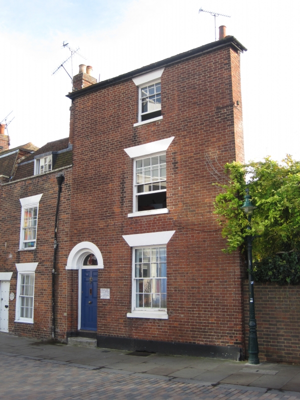
944 THE FRIARS
No 15
TR 1458 SE 2/87
II GV
2.
Early C19. 3 storeys and basement cement rendered on the side. Faced with
brick on the front elevation. 1 sash with glazing bars intact and shutters.
Left side round-headed doorcase with semi-circular fanlight and 6 fielded
panelled door. 1 stone step.
Nos 11 to 18 (consec) form a group.
Listing NGR: TR1479658002
External links are from the relevant listing authority and, where applicable, Wikidata. Wikidata IDs may be related buildings as well as this specific building. If you want to add or update a link, you will need to do so by editing the Wikidata entry.


Other nearby listed buildings
