Latitude: 51.8464 / 51°50'47"N
Longitude: 0.9963 / 0°59'46"E
OS Eastings: 606482
OS Northings: 220666
OS Grid: TM064206
Mapcode National: GBR SNW.6PZ
Mapcode Global: VHKG7.7V2F
Plus Code: 9F32RXWW+HG
Entry Name: Ruins of Church of St Peter
Listing Date: 17 November 1966
Grade: II
Source: Historic England
Source ID: 1337180
English Heritage Legacy ID: 120147
ID on this website: 101337180
Location: Alresford, Tendring, Essex, CO7
County: Essex
District: Tendring
Civil Parish: Alresford
Traditional County: Essex
Lieutenancy Area (Ceremonial County): Essex
Church of England Parish: Alresford St Andrew
Church of England Diocese: Chelmsford
ALRESFORD FORD LANE TM 02 SE (west side)
3/13 Ruins of Church of St. 17.11.66 Peter
- II
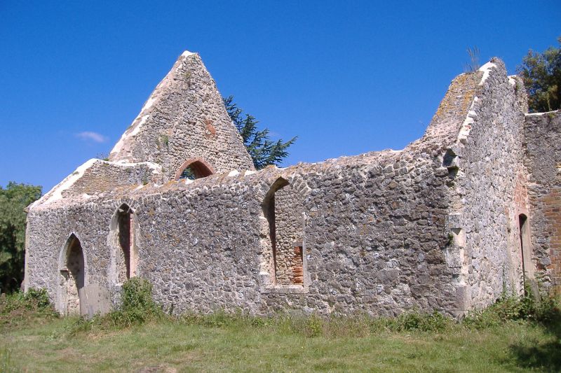
Former parish church destroyed by fire 1971. C13 origin with C14 and C19 features. Plastered rubble walls, Roman brick and tile quoins, stone dressings. Roofless, only the walls of the Chancel, Nave, North Porch and South Aisle remain. Chancel. East wall with angle buttresses, 2 centred arch east window, remains of quatrefoil tracery, label with king and queen stops. South wall east window 2 centred arch, remains of tracery. Red brick jambs of former doorway to west of this window. North wall. Two 2 centred arch windows with trefoil tracery, between these windows a Caernarvon headed doorway. Nave. North wall, two 2 centred arch windows, remains of tracery, buttress to east end. C14 2 centred arch north door, chamfered of 2 orders. Gabled north porch with 2 centred archway. West wall. Roman brick and tiled quoins, 2 centred arch window. Label over. South aisle. West wall curved triangular window with trefoil. South wall, to west a 2 centred arch doorway, to east two 2 centred arch windows. East wall, C19 segmental headed doorway. Internally few features remain there is a 2 centred arch piscina with quatrefoil drain to south wall of Chancel. C19 coloured tiles and brick and stone floor tiles to Sanctuary and Chancel. Brick window splays, stone jambs to Chancel arch. South east wall of Nave has a Caernarvon headed doorway with corbel below, possibly leading to C19 vestry or former rood loft stairs. There is a small blocked roundel to north of west wall apex and traces of a similar roundel to south of the apex and a red brick north jamb to south doorway. The south aisle western angle has trefoiled stone panelling to plinth. Kelly's Directory 1912 states the building was erected by Anfrey de Staunton circa 1300 as did appear by his epitaph in Norman-French in the Chancel. RCHM 2.
Listing NGR: TM0648220666


Other nearby listed buildings