Latitude: 51.0821 / 51°4'55"N
Longitude: 0.7609 / 0°45'39"E
OS Eastings: 593473
OS Northings: 135043
OS Grid: TQ934350
Mapcode National: GBR RXJ.15Z
Mapcode Global: FRA D6H8.683
Plus Code: 9F323QJ6+R9
Entry Name: Oakmead Farm
Listing Date: 9 August 1979
Grade: II
Source: Historic England
Source ID: 1337696
English Heritage Legacy ID: 180569
ID on this website: 101337696
Location: Woodchurch, Ashford, Kent, TN26
County: Kent
District: Ashford
Civil Parish: Woodchurch
Traditional County: Kent
Lieutenancy Area (Ceremonial County): Kent
Tagged with: Farmhouse
This list entry was subject to a Minor Amendment on 9 June 2025 to amend the name and address and to reformat the text to current standards
TQ 93 NW
5/552
WOODCHURCH
SUSANS HILL
Oakmead Farm
(Formerly listed as Dewhurst Farmhouse)
II
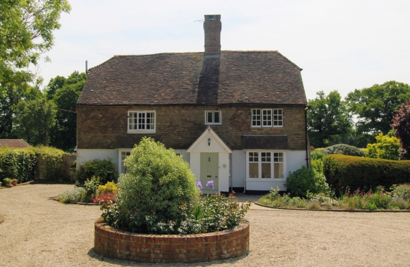
Formerly called Jewhurst Farmhouse. C18 exterior to C14 hall-house originally open hall but with ceiling inserted in late C16. Two storeys. Ground floor painted brick, above tile hung. Half-hipped tiled roof. Three casement windows. Interior contains chamfered beams and inglenook fireplace.
Listing NGR: TQ9347335043
External links are from the relevant listing authority and, where applicable, Wikidata. Wikidata IDs may be related buildings as well as this specific building. If you want to add or update a link, you will need to do so by editing the Wikidata entry.


Other nearby listed buildings