Latitude: 51.096 / 51°5'45"N
Longitude: 0.5376 / 0°32'15"E
OS Eastings: 577783
OS Northings: 136025
OS Grid: TQ777360
Mapcode National: GBR PTC.BQ2
Mapcode Global: FRA D607.38P
Plus Code: 9F323GWQ+92
Entry Name: 2, Waterloo Road
Listing Date: 19 May 1986
Grade: II
Source: Historic England
Source ID: 1338664
English Heritage Legacy ID: 169155
ID on this website: 101338664
Location: Cranbrook, Tunbridge Wells, Kent, TN17
County: Kent
District: Tunbridge Wells
Civil Parish: Cranbrook & Sissinghurst
Built-Up Area: Cranbrook
Traditional County: Kent
Lieutenancy Area (Ceremonial County): Kent
Tagged with: Building
CRANBROOK WATERLOO ROAD TQ 7736 SE (north west side) 10/304 - No 2 GV II
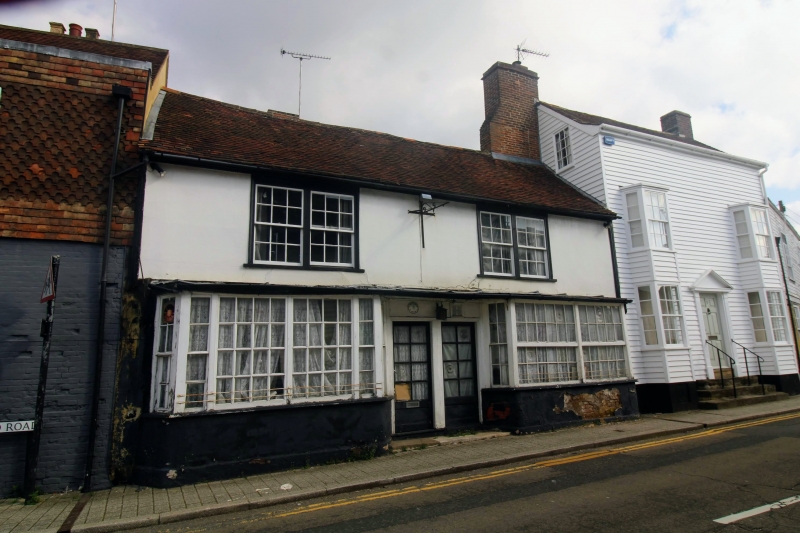
House, now restaurant. C16 with C19 elevations and alterations. Timber- framed with rendered cladding on first floor. Plain tiled roof with very large rebuilt brick stack at right end and tapering stack on rear wing to left. 2 storeys. 2 paired mid C19 glazing bar sashes on first floor. Wide mid C19. Shop front with 2 central two-thirds glazed doors in centre and projecting wide hexagonal bays either side.
Listing NGR: TQ7778336025
External links are from the relevant listing authority and, where applicable, Wikidata. Wikidata IDs may be related buildings as well as this specific building. If you want to add or update a link, you will need to do so by editing the Wikidata entry.


Other nearby listed buildings