Latitude: 51.1526 / 51°9'9"N
Longitude: 0.4347 / 0°26'4"E
OS Eastings: 570372
OS Northings: 142073
OS Grid: TQ703420
Mapcode National: GBR NR4.NQG
Mapcode Global: VHJMY.H959
Plus Code: 9F325C3M+2V
Entry Name: Barn About 50 Metres South of Yew Tree Farmhouse
Listing Date: 10 October 1989
Grade: II
Source: Historic England
Source ID: 1338793
English Heritage Legacy ID: 169963
ID on this website: 101338793
Location: Yew Tree Green, Tunbridge Wells, Kent, TN12
County: Kent
District: Tunbridge Wells
Civil Parish: Horsmonden
Traditional County: Kent
Lieutenancy Area (Ceremonial County): Kent
Church of England Parish: Brenchley All Saints
Church of England Diocese: Rochester
Tagged with: Barn
HORSMONDEN YEW TREE GREEN ROAD TQ 74 SW (south side) 1/127 Barn about 50 metres south of Yew Tree Farmhouse GV II
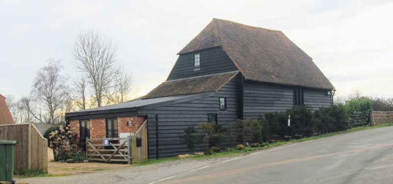
Barn. C18. Timber framed and weather boarded on red brick base with plain tiled roof. Half-hipped roof with lean-to outshots to left and to rear. Boarded door to right. Included for group value.
Listing NGR: TQ7037242073
External links are from the relevant listing authority and, where applicable, Wikidata. Wikidata IDs may be related buildings as well as this specific building. If you want to add or update a link, you will need to do so by editing the Wikidata entry.


Other nearby listed buildings