Latitude: 51.1258 / 51°7'32"N
Longitude: 0.2574 / 0°15'26"E
OS Eastings: 558062
OS Northings: 138703
OS Grid: TQ580387
Mapcode National: GBR MPY.CW6
Mapcode Global: VHHQD.DYXV
Plus Code: 9F3247G4+8X
Entry Name: Pavement to the Pantiles
Listing Date: 7 June 1974
Grade: II
Source: Historic England
Source ID: 1338854
English Heritage Legacy ID: 168148
ID on this website: 101338854
Location: Royal Tunbridge Wells, Tunbridge Wells, Kent, TN2
County: Kent
District: Tunbridge Wells
Electoral Ward/Division: Pantiles and St Mark's
Parish: Non Civil Parish
Built-Up Area: Royal Tunbridge Wells
Traditional County: Kent
Lieutenancy Area (Ceremonial County): Kent
Church of England Parish: Tunbridge Wells King Charles the Martyr
Church of England Diocese: Rochester
Tagged with: Architectural structure
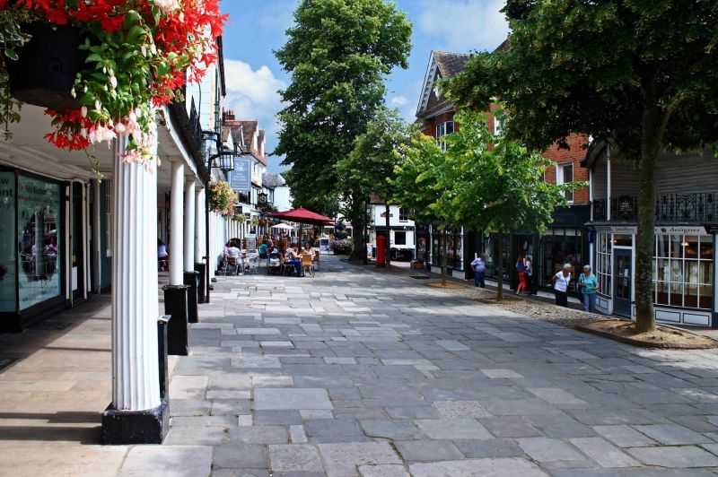
THE PANTILES 1. 1746 (North West Side) Pavement to the Pantiles TQ 5838 NW 1/299 II 2. A pavement of stone flags.
Listing NGR: TQ5803738674
External links are from the relevant listing authority and, where applicable, Wikidata. Wikidata IDs may be related buildings as well as this specific building. If you want to add or update a link, you will need to do so by editing the Wikidata entry.


Other nearby listed buildings