Approximate Location Map
Large Map »
Latitude: 51.0415 / 51°2'29"N
Longitude: -1.5346 / 1°32'4"W
OS Eastings: 432724
OS Northings: 127007
OS Grid: SU327270
Mapcode National: GBR 74M.NTH
Mapcode Global: FRA 76NC.KXW
Plus Code: 9C3W2FR8+H5
Entry Name: Wall Bounding Lawn Running from North East of Mottisfont Abbey
Listing Date: 11 April 1986
Grade: II
Source: Historic England
Source ID: 1339149
English Heritage Legacy ID: 140988
ID on this website: 101339149
Location: Mottisfont, Test Valley, Hampshire, SO51
County: Hampshire
District: Test Valley
Civil Parish: Mottisfont
Traditional County: Hampshire
Lieutenancy Area (Ceremonial County): Hampshire
Church of England Parish: Mottisfont St Andrew
Church of England Diocese: Winchester
Tagged with: Wall
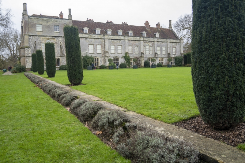
MOTTISFONT MOTTISFONT ABBEY
SU 3227 & SU 3226
11/4 & 12/4 Wall bounding lawn run-
ning from NE of Mottis-
font Abbey
GV II
Wall. C18. Ashlar stone. 50m long wall, low of on block of stone with coping
on top running from NE corner, bounding lawn to E.
Listing NGR: SU3261827007
External links are from the relevant listing authority and, where applicable, Wikidata. Wikidata IDs may be related buildings as well as this specific building. If you want to add or update a link, you will need to do so by editing the Wikidata entry.


Other nearby listed buildings
