Approximate Location Map
Large Map »
Latitude: 50.9516 / 50°57'5"N
Longitude: -1.5102 / 1°30'36"W
OS Eastings: 434500
OS Northings: 117021
OS Grid: SU345170
Mapcode National: GBR 75T.90D
Mapcode Global: FRA 76QL.HGX
Plus Code: 9C2WXF2Q+JW
Entry Name: Granary, 25 Metres North West of Moorcourt
Listing Date: 17 November 1986
Grade: II
Source: Historic England
Source ID: 1339184
English Heritage Legacy ID: 141191
ID on this website: 101339184
Location: Test Valley, Hampshire, SO51
County: Hampshire
District: Test Valley
Civil Parish: Romsey Extra
Traditional County: Hampshire
Lieutenancy Area (Ceremonial County): Hampshire
Church of England Parish: Romsey St Mary and St Ethelflaeda
Church of England Diocese: Winchester
Tagged with: Granary
ROMSEY EXTRA RIDGE LANE
SU 31 NW
6/16 Granary, 25m NW of
Moorcourt
GV II
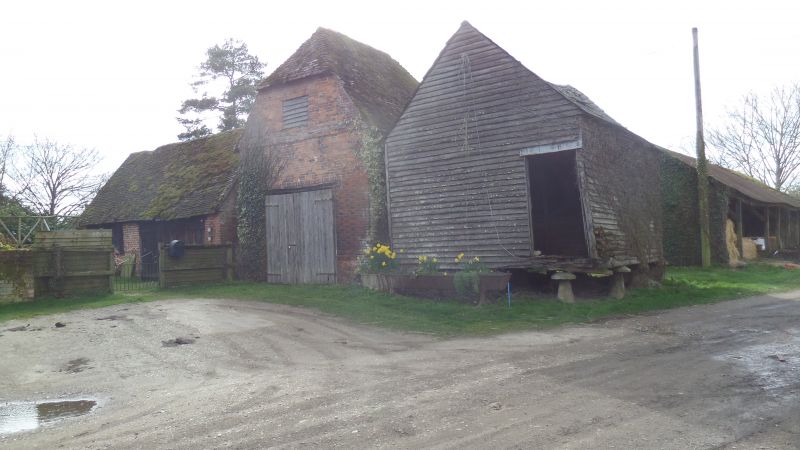
Granary. Early C19. Timber frame on 3 x 4 staddles, with boarded walls, and
slate roof. Included for group value.
Listing NGR: SU3506819411
External links are from the relevant listing authority and, where applicable, Wikidata. Wikidata IDs may be related buildings as well as this specific building. If you want to add or update a link, you will need to do so by editing the Wikidata entry.


Other nearby listed buildings
