Latitude: 51.2095 / 51°12'34"N
Longitude: -1.4788 / 1°28'43"W
OS Eastings: 436505
OS Northings: 145715
OS Grid: SU365457
Mapcode National: GBR 72R.4Y3
Mapcode Global: VHC2S.BV2P
Plus Code: 9C3W6G5C+QF
Entry Name: 90, High Street
Listing Date: 24 June 1983
Grade: II
Source: Historic England
Source ID: 1339268
English Heritage Legacy ID: 139510
ID on this website: 101339268
Location: Andover, Test Valley, Hampshire, SP10
County: Hampshire
District: Test Valley
Civil Parish: Andover
Built-Up Area: Andover
Traditional County: Hampshire
Lieutenancy Area (Ceremonial County): Hampshire
Church of England Parish: Andover St Mary
Church of England Diocese: Winchester
Tagged with: Building
SU 3645 NE ANDOVER HIGH STREET 4/52 (east side) No 90
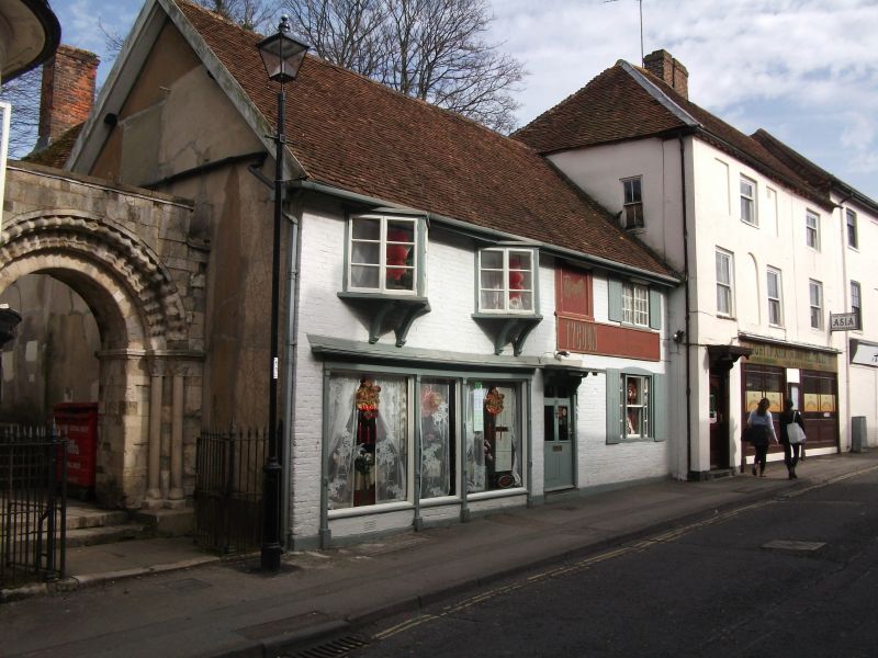
GV II C16, C18, early Cl9. Timber-framed building of 2 storeys, now refronted in brick except for a gable at the rear. Tile roof. Red brick work in Flemish bond, cambered ground floor opening at the east side. Two upper wedge-shaped casements on coupled brackets, one upper sliding sash. Central doorcase with cornice on brackets, architrave, 6-panelled door. Victorian shopfront of slender proportions, with cornice, frieze, 4 half columns, plinth. The rendered west elevation abuts a flight of steps to the churchyard.
Listing NGR: SU3650545715
External links are from the relevant listing authority and, where applicable, Wikidata. Wikidata IDs may be related buildings as well as this specific building. If you want to add or update a link, you will need to do so by editing the Wikidata entry.


Other nearby listed buildings