Latitude: 51.2542 / 51°15'15"N
Longitude: -0.9395 / 0°56'22"W
OS Eastings: 474105
OS Northings: 151095
OS Grid: SU741510
Mapcode National: GBR C86.99D
Mapcode Global: VHDXS.NQPW
Plus Code: 9C3X7336+M6
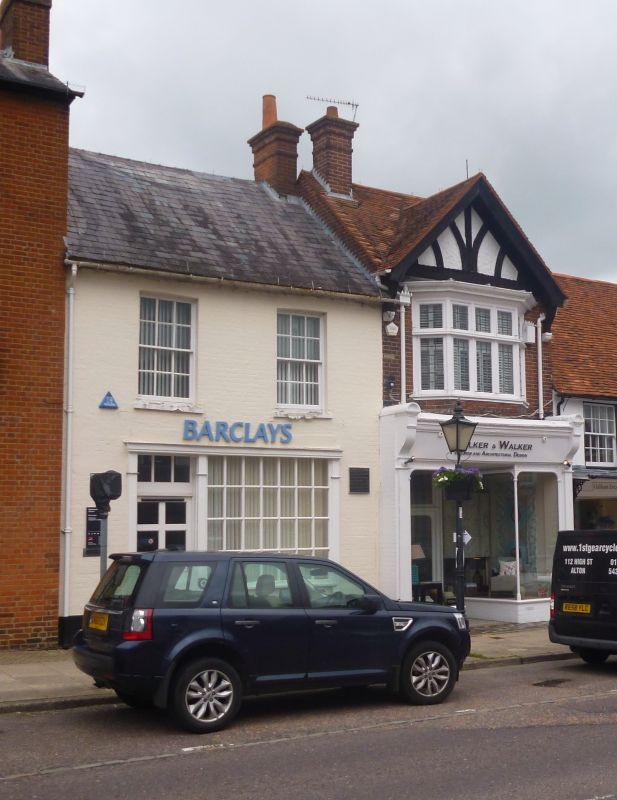
Entry Name: Barclays Bank
Listing Date: 26 June 1987
Grade: II
Source: Historic England
Source ID: 1339907
English Heritage Legacy ID: 136999
ID on this website: 101339907
Location: Odiham, Hart, Hampshire, RG29
County: Hampshire
District: Hart
Civil Parish: Odiham
Built-Up Area: Odiham
Traditional County: Hampshire
Lieutenancy Area (Ceremonial County): Hampshire
Church of England Parish: Odiham All Saints
Church of England Diocese: Winchester
Tagged with: Bank building
SU 73-7450 & 73-7451 ODIHAM HIGH STREET
(north side)
17/21
No 80
- (Barclays Bank)
GV II
C18. 2 storeys, windows. Slate roof. Painted brickwork, Flemish bond.
Sashes in reveals to 1st floor. Ground floor has a modern shopfront in a
delicate Georgian style. Included for group value.
Listing NGR: SU7410251108
External links are from the relevant listing authority and, where applicable, Wikidata. Wikidata IDs may be related buildings as well as this specific building. If you want to add or update a link, you will need to do so by editing the Wikidata entry.


Other nearby listed buildings