Latitude: 51.7871 / 51°47'13"N
Longitude: -2.1934 / 2°11'36"W
OS Eastings: 386757
OS Northings: 209848
OS Grid: SO867098
Mapcode National: GBR 1M0.XZG
Mapcode Global: VH94R.XBTT
Plus Code: 9C3VQRP4+VJ
Entry Name: Ashton House
Listing Date: 24 August 1990
Grade: II
Source: Historic England
Source ID: 1340500
English Heritage Legacy ID: 133267
ID on this website: 101340500
Location: Painswick, Stroud, Gloucestershire, GL6
County: Gloucestershire
District: Stroud
Civil Parish: Painswick
Built-Up Area: Painswick
Traditional County: Gloucestershire
Lieutenancy Area (Ceremonial County): Gloucestershire
Church of England Parish: Painswick St Mary the Virgin
Church of England Diocese: Gloucester
Tagged with: House
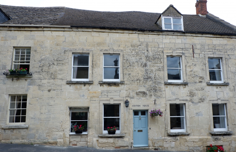
PAINSWICK GLOUCESTER STREET SO 8609/8709 (part of) (east side) 8/89 Ashton House GV II House at bottom end of row. Early C19 front to C17 or C18 body. Large square limestone blocks to street front, concrete tile roof to coped verge with brick stack. Street front hard on pavement edge, building runs back to 2 gables at rear. Two storeys, attic, part basement; 4 windows. At ground floor a plain sash set back in blocked door opening, and 3 plain sashes with plain stone architraves with keystone and projecting sill. At first floor, four sashes in 2 + 2 grouping, same surrounds at below; a small 2-light gabled dormer at eaves, right. 6-paned door in deep reveal between paired windows, two panels glazed, and under flat stone lintel with incised name. Plinth dying into pavement to left, contains square opening set very low below fourth window. One of back wings has an eaves stack. Frontage and roof continuous with St Anne's (q.v.).
Listing NGR: SO8675709848
External links are from the relevant listing authority and, where applicable, Wikidata. Wikidata IDs may be related buildings as well as this specific building. If you want to add or update a link, you will need to do so by editing the Wikidata entry.


Other nearby listed buildings