Latitude: 51.3873 / 51°23'14"N
Longitude: 1.3828 / 1°22'58"E
OS Eastings: 635459
OS Northings: 170792
OS Grid: TR354707
Mapcode National: GBR WZS.VVW
Mapcode Global: VHLG6.XDDC
Plus Code: 9F3399PM+W4
Entry Name: 6, Cecil Street
Listing Date: 22 February 1973
Grade: II
Source: Historic England
Source ID: 1341508
English Heritage Legacy ID: 356513
ID on this website: 101341508
Location: Margate, Thanet, Kent, CT9
County: Kent
District: Thanet
Electoral Ward/Division: Margate Central
Parish: Non Civil Parish
Built-Up Area: Margate
Traditional County: Kent
Lieutenancy Area (Ceremonial County): Kent
Tagged with: Building
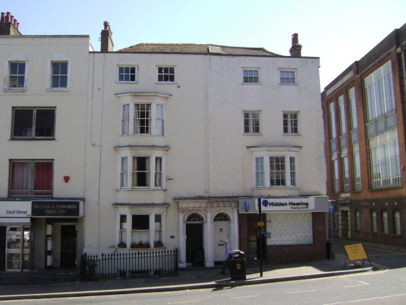
CECIL STREET
1.
1380
(East Side)
No 6
TR 3570 NW 1/125
II GV
2.
Early C19. 4 storeys pebble dash. Stone coping. 2 sashes with some glazing
bars intact, 3-light canted bay on 1st floor. Modern shopfront. Grade II for
group value with No 5.
No 6 forms a group with No 5
Listing NGR: TR3545970792
External links are from the relevant listing authority and, where applicable, Wikidata. Wikidata IDs may be related buildings as well as this specific building. If you want to add or update a link, you will need to do so by editing the Wikidata entry.


Other nearby listed buildings