Latitude: 51.3876 / 51°23'15"N
Longitude: 1.3828 / 1°22'58"E
OS Eastings: 635461
OS Northings: 170823
OS Grid: TR354708
Mapcode National: GBR WZS.VVS
Mapcode Global: VHLG6.XDD4
Plus Code: 9F3399QM+24
Entry Name: 1, Cecil Street
Listing Date: 22 February 1973
Grade: II
Source: Historic England
Source ID: 1088994
English Heritage Legacy ID: 356510
ID on this website: 101088994
Location: Margate, Thanet, Kent, CT9
County: Kent
District: Thanet
Electoral Ward/Division: Margate Central
Parish: Non Civil Parish
Built-Up Area: Margate
Traditional County: Kent
Lieutenancy Area (Ceremonial County): Kent
Tagged with: Building
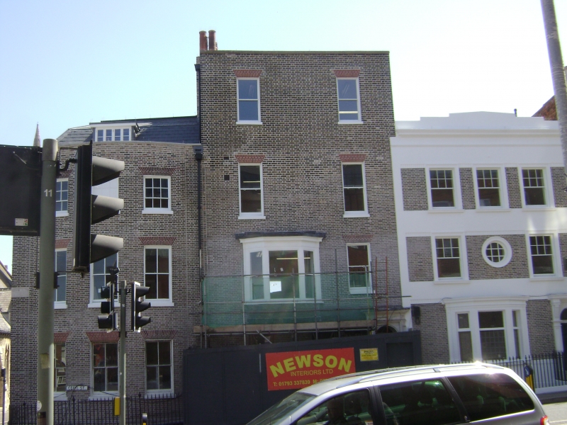
CECIL STREET
1.
1380
(East Side)
No 1
TR 3570 NW 1/34
II GV
2.
Late C18. 4 storeys and basement stock brick, partly painted. Stone coping.
2 sashes with verticals only, 1 3-light canted bay on 1st floor. Right side
doorcase has paterae, fluted pilasters, panelled reveals and a fielded panelled
door. Spear railings. Grade II for group value.
Nos 1 and 2 form a group with No 1 Union Crescent
Listing NGR: TR3546170823
External links are from the relevant listing authority and, where applicable, Wikidata. Wikidata IDs may be related buildings as well as this specific building. If you want to add or update a link, you will need to do so by editing the Wikidata entry.


Other nearby listed buildings