Approximate Location Map
Large Map »
Latitude: 51.9832 / 51°58'59"N
Longitude: -1.7202 / 1°43'12"W
OS Eastings: 419311
OS Northings: 231678
OS Grid: SP193316
Mapcode National: GBR 4P9.PWN
Mapcode Global: VHBYZ.4FF0
Plus Code: 9C3WX7MH+7W
Entry Name: Upperfields Farmhouse
Listing Date: 30 June 1983
Grade: II
Source: Historic England
Source ID: 1341662
English Heritage Legacy ID: 126636
ID on this website: 101341662
Location: Cotswold, Gloucestershire, GL56
County: Gloucestershire
District: Cotswold
Civil Parish: Moreton-in-Marsh
Traditional County: Gloucestershire
Lieutenancy Area (Ceremonial County): Gloucestershire
Church of England Parish: Moreton-in-Marsh St David
Church of England Diocese: Gloucester
Tagged with: Farmhouse
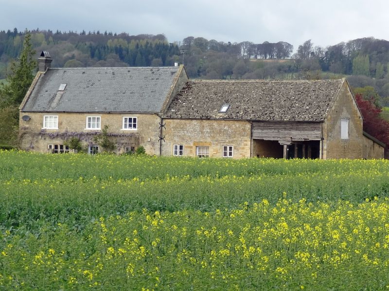
1.
5224 MORETON-IN-THE-MARSH BOURTON ROAD
(south side)
Upperfields Farmhouse
SP 13 SE 1/100
II
2.
Late C17 altered and extended. Coursed and squared rubble. Slate roof with
coped verges. Two-storeys and gable lit attics. Three windows on first
floor (modern), 2 on ground floor. 4 and 3 light mullioned type, the right hand
one with drip. Modern door in centre. West gable has staggered single light
windows (to stairs) with cornices. Circa 1800 extension of similar height to right,
stone roof, 2 light mullioned windows flanking plain door. Further later extension
with open ground floor.
Listing NGR: SP1931131678
External links are from the relevant listing authority and, where applicable, Wikidata. Wikidata IDs may be related buildings as well as this specific building. If you want to add or update a link, you will need to do so by editing the Wikidata entry.


Other nearby listed buildings
