Latitude: 51.7903 / 51°47'25"N
Longitude: -2.0443 / 2°2'39"W
OS Eastings: 397041
OS Northings: 210188
OS Grid: SO970101
Mapcode National: GBR 2NK.L0Q
Mapcode Global: VHB29.J83C
Plus Code: 9C3VQXR4+47
Entry Name: Milestone
Listing Date: 24 June 1985
Grade: II
Source: Historic England
Source ID: 1341803
English Heritage Legacy ID: 127229
ID on this website: 101341803
Location: Cotswold, Gloucestershire, GL53
County: Gloucestershire
District: Cotswold
Civil Parish: Winstone
Traditional County: Gloucestershire
Lieutenancy Area (Ceremonial County): Gloucestershire
Church of England Parish: Winstone St Bartholomew
Church of England Diocese: Gloucester
Tagged with: Milestone
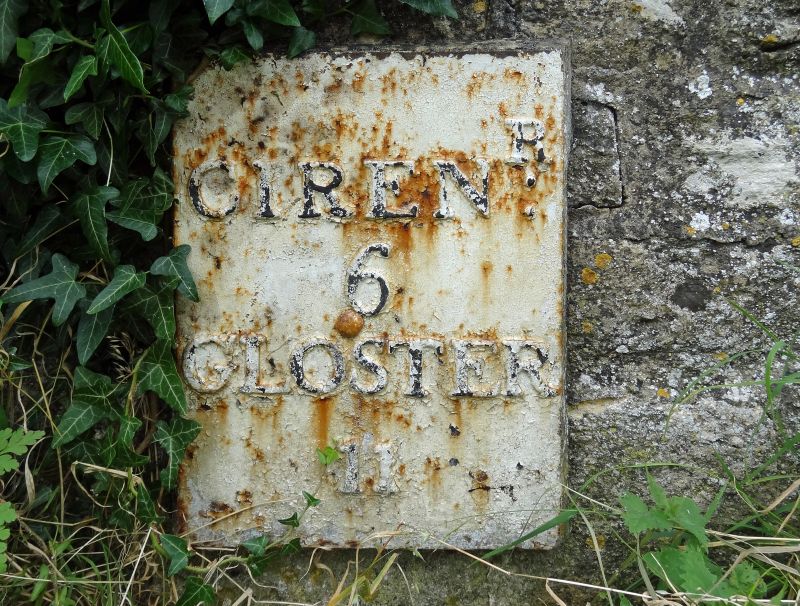
SO 91 SE WINSTONE A 417
(east side) Beechpike
3/129 Milestone
II
Milestone. C19. Iron plate with raised lettering mounted on
boundary wall; plate secured with central bolt. Plate reads:
'CIRENR./ 6/ GLOSTER/ 11'.
Listing NGR: SO9704110188
External links are from the relevant listing authority and, where applicable, Wikidata. Wikidata IDs may be related buildings as well as this specific building. If you want to add or update a link, you will need to do so by editing the Wikidata entry.


Other nearby listed buildings