Latitude: 51.7928 / 51°47'34"N
Longitude: -0.0061 / 0°0'21"W
OS Eastings: 537608
OS Northings: 212339
OS Grid: TL376123
Mapcode National: GBR KBT.K8M
Mapcode Global: VHGPP.V64H
Plus Code: 9C3XQXVV+4H
Entry Name: Amwell Marsh Pumping Station
Listing Date: 30 September 1983
Grade: II
Source: Historic England
Source ID: 1342221
English Heritage Legacy ID: 355814
ID on this website: 101342221
Location: Great Amwell, East Hertfordshire, SG12
County: Hertfordshire
District: East Hertfordshire
Civil Parish: Great Amwell
Traditional County: Hertfordshire
Lieutenancy Area (Ceremonial County): Hertfordshire
Church of England Parish: Great Amwell with St Margaret's
Church of England Diocese: St.Albans
Tagged with: Architectural structure
GREAT AMWELL AMWELL LANE TL 3712 (south side)
12/4 Amwell Marsh Pumping Station GV II
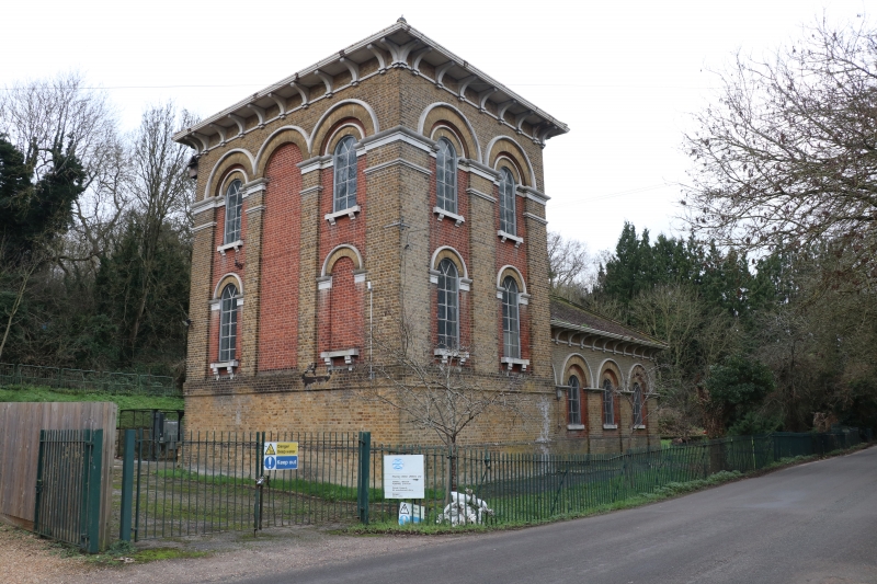
Pumping Station building. 1883 for the New River Company, erected by Frederick Hitch of Ware. Yellow stock brick with portland stone dressings, red brick inset panels and hipped red tile roofs. A tall rectangular engine house raised on a high base with outside stair at rear (S). Elaborate arcaded treatment with recessed panels of red brick. Portland stone used for moulded necking, imposts, dripmould, corbelled window sills and large brackets to wide eaves. 3-bay E-face has round arched windows in the outer bays at 2 levels with cast iron frames. 2-bay S front and N front to road similar. Low single storey L-shaped range attached on W has same elaborate treatment and arcading. Originally steam driven and said to have had a beam-engine. Forms a group with the Engineers House beside The New River. (Branch Johnson (1970) 100: Pevsner (1977) 150).
Listing NGR: TL3760812339
External links are from the relevant listing authority and, where applicable, Wikidata. Wikidata IDs may be related buildings as well as this specific building. If you want to add or update a link, you will need to do so by editing the Wikidata entry.


Other nearby listed buildings