Latitude: 52.4707 / 52°28'14"N
Longitude: -1.8815 / 1°52'53"W
OS Eastings: 408149
OS Northings: 285871
OS Grid: SP081858
Mapcode National: GBR 64D.H6
Mapcode Global: VH9Z3.B5Q8
Plus Code: 9C4WF4C9+7C
Entry Name: The Moseley Arms Public House
Listing Date: 8 July 1982
Grade: II
Source: Historic England
Source ID: 1343145
English Heritage Legacy ID: 217523
ID on this website: 101343145
Location: Deritend, Birmingham, West Midlands, B12
County: Birmingham
Parish: Non Civil Parish
Built-Up Area: Birmingham
Traditional County: Warwickshire
Lieutenancy Area (Ceremonial County): West Midlands
Church of England Parish: Highgate
Church of England Diocese: Birmingham
Tagged with: Pub
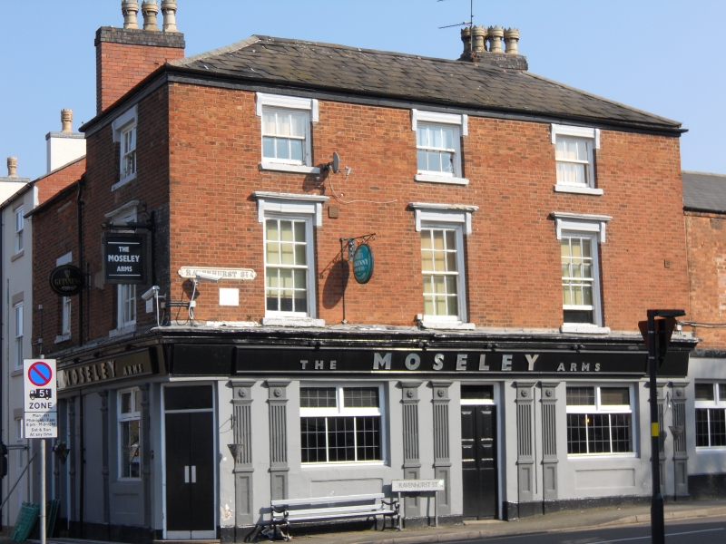
RAVENHURST STREET 1. 5104 Highgate B17 The Moseley Arms Public House SP 0885 NW 53/11 II 2. Circa 1840 public house on corner with Moseley Road. Three storeys red brick with stucco ground floor. Three bay front with one bay return and 2 storey extensions. Hipped slate roof with eaves band. Revealed glazing bar sashes to upper floors, tall on first floor with architrave moulded stucco heads flanked by shallow consoles to thin cornices. Second floor window have similar heads but they abutt eaves band without cornices. Public house front with coupled fluted and panelled pilasters, deep fascia with projecting cornice returned to Moseley Road.
Listing NGR: SP0814985871
External links are from the relevant listing authority and, where applicable, Wikidata. Wikidata IDs may be related buildings as well as this specific building. If you want to add or update a link, you will need to do so by editing the Wikidata entry.


Other nearby listed buildings