Latitude: 53.5521 / 53°33'7"N
Longitude: -3.0873 / 3°5'14"W
OS Eastings: 328060
OS Northings: 406711
OS Grid: SD280067
Mapcode National: GBR 6WWC.DD
Mapcode Global: WH758.KZ28
Plus Code: 9C5RHW27+R3
Entry Name: Church of St Luke
Listing Date: 19 July 1966
Grade: II
Source: Historic England
Source ID: 1343284
English Heritage Legacy ID: 216442
ID on this website: 101343284
Location: St Luke's Church, Sefton, Merseyside, L37
County: Sefton
Civil Parish: Formby
Built-Up Area: Formby
Traditional County: Lancashire
Lieutenancy Area (Ceremonial County): Merseyside
Church of England Parish: Formby St Luke
Church of England Diocese: Liverpool
Tagged with: Church building Gothic Revival
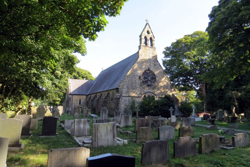
FORMBY ST. LUKE'S CHURCH ROAD SD 20 NE (west side) 2/44 Church of 19.7.66 St. Luke G.V. II Church. 1852-3. By. W. Culshaw. Rock-faced stone with ashlar dressings and slate roof. Nave, transepts, chancel and south porch. 5-bay nave has 2-light windows with simple Geometrical tracery between weathered buttresses. West front has window of 3 trefoil-headed lights with shafts and segmental hood mould continued as drip mould. Foundation stone below and rose window above. Diagonal buttresses and bellcote. South porch has clasping buttresses. Transepts have diagonal buttresses, 2-light windows and louvred trefoils, that to north has east entrance and chimney, that to south has east entrance with window above. Chancel has parapet with quatrefoil piercings, gabled angle buttresses and 3-light east window. Interior has arch-braced collar trusses on corbels. Good stained glass in west windows. Arches to transepts die into jambs, north organ loft, south vestry. Brass altar rail. Norman font, of simple form with cable moulding.
Listing NGR: SD2806006711
External links are from the relevant listing authority and, where applicable, Wikidata. Wikidata IDs may be related buildings as well as this specific building. If you want to add or update a link, you will need to do so by editing the Wikidata entry.


Other nearby listed buildings