Latitude: 53.458 / 53°27'28"N
Longitude: -2.9639 / 2°57'50"W
OS Eastings: 336093
OS Northings: 396127
OS Grid: SJ360961
Mapcode National: GBR 782.VD
Mapcode Global: WH871.FBVW
Plus Code: 9C5VF25P+6C
Entry Name: 32-54, HORNBY ROAD (See details for further address information)
Listing Date: 14 March 1975
Grade: II
Source: Historic England
Source ID: 1343613
English Heritage Legacy ID: 214317
ID on this website: 101343613
Location: Orrell Park, Liverpool, Merseyside, L9
County: Liverpool
Electoral Ward/Division: Warbreck
Parish: Non Civil Parish
Built-Up Area: Liverpool
Traditional County: Lancashire
Lieutenancy Area (Ceremonial County): Merseyside
Church of England Parish: Walton St John
Church of England Diocese: Liverpool
Tagged with: Building Terrace of houses
SJ 3696 HORNBY ROAD L9
13/644 Nos. 32 to 54 (even) 14.3.75 G.V. II
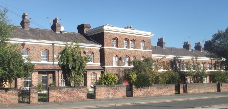
Includes No. 1 Hornby Place (formerly listed with No. 2 Hornby Place). Terrace of 13 houses. Brick with stone dressings, slate roof. 2 storeys, end bay and Nos. 44 and 46 of 3 storeys and projecting bays have blocking course and hipped roofs. Segmental-headed windows have recessed reveals (most sashes gone 1984). Round-headed entrances have no doors (1984). Recessed bays have rectangular bay windows, with continuous lean-to roofs, forming canopies to entrances. End bay forms return to No. 1 Hornby Place, 3 bays, with central round-headed entrance. The terrace would be symmetrical like Nos. 2 to 30 (q.v.) but three houses appear to have been demolished at left hand end.
Listing NGR: SJ3609396127
External links are from the relevant listing authority and, where applicable, Wikidata. Wikidata IDs may be related buildings as well as this specific building. If you want to add or update a link, you will need to do so by editing the Wikidata entry.


Other nearby listed buildings