Approximate Location Map
Large Map »
Latitude: 51.0721 / 51°4'19"N
Longitude: 1.0873 / 1°5'14"E
OS Eastings: 616382
OS Northings: 134840
OS Grid: TR163348
Mapcode National: GBR V0L.RQP
Mapcode Global: FRA F659.1FG
Plus Code: 9F3333CP+RW
Entry Name: 125, High Street
Listing Date: 21 December 1973
Grade: II
Source: Historic England
Source ID: 1344077
English Heritage Legacy ID: 175115
ID on this website: 101344077
Location: Hythe, Folkestone and Hythe, Kent, CT21
County: Kent
District: Folkestone and Hythe
Civil Parish: Hythe
Built-Up Area: Hythe
Traditional County: Kent
Lieutenancy Area (Ceremonial County): Kent
Tagged with: Building
1.
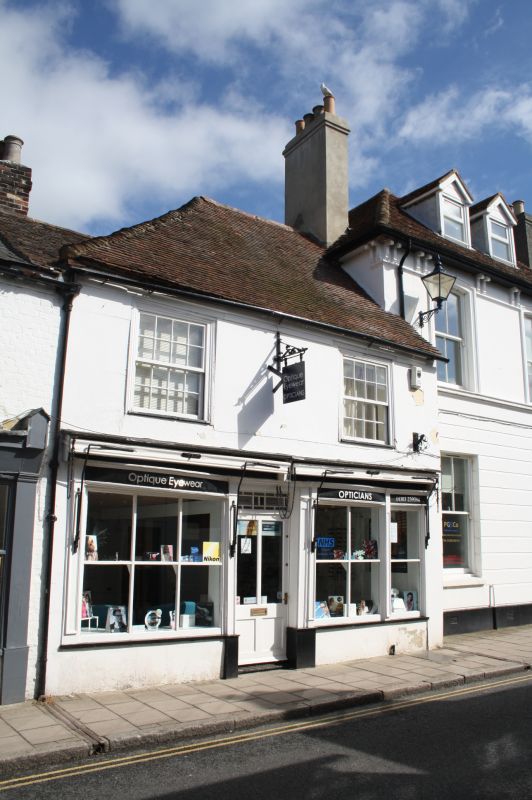
1253 HIGH STREET
(North Side)
No 125
TR 1634 NW 2/12
II GV
2.
C18. 2 storeys stuccoed. Tiled roof. 2 sashes with glazing bars intact on
1st floor. The shop front has a curved top but a flat shop window has been
inserted below this.
Nos 115 to 125 (odd) form a group.
Listing NGR: TR1638134842
External links are from the relevant listing authority and, where applicable, Wikidata. Wikidata IDs may be related buildings as well as this specific building. If you want to add or update a link, you will need to do so by editing the Wikidata entry.


Other nearby listed buildings
