Latitude: 51.1865 / 51°11'11"N
Longitude: -2.5079 / 2°30'28"W
OS Eastings: 364601
OS Northings: 143154
OS Grid: ST646431
Mapcode National: GBR MV.5GFX
Mapcode Global: VH8B1.HF1S
Plus Code: 9C3V5FPR+JV
Entry Name: Unidentified Monument in Churchyard, 16 Metres North of Nave of Church of St Aldhelm
Listing Date: 25 February 1988
Grade: II
Source: Historic England
Source ID: 1345193
English Heritage Legacy ID: 268334
ID on this website: 101345193
Location: St Aldhelm's Church, Doulting, Somerset, BA4
County: Somerset
District: Mendip
Civil Parish: Doulting
Traditional County: Somerset
Lieutenancy Area (Ceremonial County): Somerset
Tagged with: Monument
DOULTING CP CHURCH LANE (South side) ST6443 12/130 Unidentified monument in churchyard, 16m north of nave of - Church of St. Aldhelm GV II
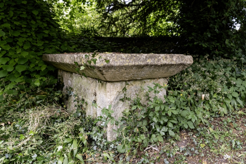
Chest tomb. C17. Dressed stone. Oblong chest, very thick slab top chamfered to lower edge. All inscriptions decayed.
Listing NGR: ST6460143154
External links are from the relevant listing authority and, where applicable, Wikidata. Wikidata IDs may be related buildings as well as this specific building. If you want to add or update a link, you will need to do so by editing the Wikidata entry.


Other nearby listed buildings